Category Archives: None

You Readers Made Me Do It

Well, you did it. A few of you encouraged me to write a book a couple of years ago. It’s your fault. So now you can post a self congratulations on your social media outlets, “I told this guy to write a book and he did.”

Careful what you ask for. You can get to the book’s Amazon page with the link that they sent me when it finally passed all the formatting issues:

Congratulations, your paperback, “MEMOIRS OF A ROMANTIC SPACE CADET: HOW LSD (AND PEPSI) SAVED MY LIFE!,” is available to buy on Amazon.

It’s been available since the 1st but I wanted a copy in my hands before posting anything. This is not a memoir for my grandchildren to read or be read to, not yet anyway. It is really an exercise in memory. One story brought up another and another and some that I had long ago buried suddenly appeared – bringing some big smiles. Some, perhaps, should not be in print, but, WTF!

I see some jaws dropping out there. Wait till you read it. Apologies in advance to 93% of the world.

As for the Odyssey blog, that will continue when we get on the road again, you know, for the fun of it. We are in Gold Canyon, Arizona now, workamping in spectacular weather – might be a little warm. We took a different route this year that took us through Show Low, AZ, on US 60 and then deep into the Salt River Canyon. Gorgeous:

And, the Arizona sunsets are always worth a happy hour toast:

We did take a spectacular trip to Greece this past May – with the kids, and, yes, the grandkids (at 2 and 4)! It was fine. If you go to Greece, just take 2 days in Athens, see the Parthenon, and then island hop. High speed ferry is great. If time is limited, just go to Santorini and stay at an AirB&B in Oia. You might want to spend the rest of your life there.

Getting back to the book – give it a try. Not sure how many “experienced” space cadets we have out there but a license or training is not required. Just strap in, step back, and take a ride. No guarantees about altering your mind, just keep it open and go with rule number two on this one: have a good time.

Spread the word (and the link). If that first link doesn’t work, try pasting this into your browser.

https://www.amazon.com/gp/r.html?C=2EIU1YSKTC6SW&K=AX9MKXA3K145&M=urn:rtn:msg:201911012223140326e23b0d2a4fa79a55184d37e0p0na&R=HG5QRKF5G38V&T=C&U=https%3A%2F%2Fwww.amazon.com%2Fdp%2F1701541971%3Fref_%3Dpe_3052080_397514860&H=E79APWRJLMHCESOTCZIAYNEOVTWA&ref_=pe_3052080_397514860

Forget Google – I’m nobody there – wait, it just came up on 11/10/19 in Google. The search results show the Amazon Japanese version. Does that mean someone in Japan looked at the ad? Holy Japoly!

Some other Brian Carlin’s load up the results.

Or, just open the Amazon app and search for:
brian carlin amazon memoirs of a romantic space cadet.

That’s all folks.

Long Time Gone (1)

(Crosby, Stills, and Nash – start singing. Come on, get in the mood)
It’s been a long time comin’
It’s goin’ to be a long time gone

And it appears to be a long
Appears to be a long
Appears to be a long time
Yes, a long, long, long, long time before the dawn

Go ahead, I won’t be insulted if you pause me for a couple of minutes. Go on, find that sucker on your phone or computer (you still use your computer?) and play it. You don’t have it? Who doesn’t have the self-titled album ‘Crosby, Stills, And Nash’? Yeah, it’s not as good as ‘Deja Vu’, but it also didn’t have Neil Young. That was a talented bunch of guys – David Crosby was from the Byrds since their day one; Stephen Stills came from Buffalo Springfield (For What It’s Worth) with his buddy, Neil Young; Graham Nash, the vocalist from the Hollies (he had a fling with Joni Mitchell); Neil Young, with his buddy, Stephen Stills, you know, Buffalo Springfield – he had also been recording with his own group, Crazy Horse. I’m ok if you just put me on hold and go listen to some of their stuff. As a matter of fact, please do! Listen amongst yourself.

OK. Let’s get going. Or catch up.

It’s really been a long time, like you might have thought I died. It happens. Old people die. Well, it didn’t happen, but lots did. Die, that is. Luckily, nobody I knew too closely. Condolences to you who lost loved ones. That’s all I got for serious talk.

We got back to Colorado in the middle of July and then settled in for a couple of months. All that driving took its toll on the RV, Odyssey. We have a spider shot on the windshield, far upper right, that may or may not be a $1,000 repair. Our left rear jack lifts us up to put us into a level position but it then fails and drops back down. The driver’s side slide, after some repairs, still has some characteristics of a parallelogram with a little tilt to the front. There are lots of other little thingies that need “adjustments”.

In mid-September, we drove into a repair shop, #Premier Auto and RV, in Falcon, some 15 miles east of Colorado Springs. I added the “#” to their name hoping internet searches might find every sentence that I mention their despicable name. The allure was that they had electric and water so you could stay in your RV during repairs. After two weeks they hadn’t done shit yet charged us for work done so I reviewed them on Google and told the truth – that they were filthy, lying cheats!

The next day, five people, including the owners and managers descended upon us, trying to resolve our issues, not exactly to our satisfaction, but just enough to change my review. After a few days of trying to change our minds without actually doing anything substantial, the head guy, I think the asshole’s name was Devin, decided he could not ever make us happy. He then made a deal with us that felt as though he was holding us hostage. If he fixed a couple of our items within a week, would we change our review? At that point, we just wanted to get away from the devil.

We agreed to the ransom. They did a shitty job with everything they did. We felt good about leaving, at any cost. Devin is the Devil. If you own an RV, avoid #Falcon, Colorado. The town is evil. It hosts the devil. Stay away at all costs and tell everyone you know that #Premier Auto and RV is a living and breathing manifestation of Beelzebub. Ok, maybe that’s a bit much. They are just a bunch of low life criminals.

But, I digress. We escaped after paying a substantial ransom and bolted south. One problem they couldn’t fix was a smell that developed after they brought the slide in and out numerous times. That smell, which everyone thought was sewer odor, followed us.

After the obligatory stop in Raton, New Mexico, we headed to Albuquerque, to get an oil change at #Statkus Engines, the place that made us feel like they saved us the year before, charging us $3000 to fix a $100 part. I’m beginning to think I have a huge “Sucker” sign on my forehead. After the bill for that oil change I’m sure of it. Thank you Mr. Statkus for making me believe that every RV repair shop is run by Lucifer’s armies. I hate you all!

We left very late in the afternoon into the setting sun on I-40 and stopped at the Sky City Casino before it got dark. Never pull into an RV park after dark. That’s our motto. It was another forty, fifty miles to Grants but everything there was full and too far to Gallups. Sky City has a parking lot with full hookup pull-thru’s. It was fine for an overnight stay. We’re not big fans of driving more than a couple of hundred miles in a day, so with Mesa another 350 down the road, we made one more stop in Holbrook, AZ, the OK RV Park. It’s perfect for an overnighter, say, to and from the Phoenix area. Stay a day or two and see the Painted Desert and Petrified Forest National Park. You might want to stop at Knife City, if that floats your boat. Their billboards start about 100 miles away.

The drive from Holbrook to Payson is pretty boring but from Payson to Mesa is beautiful. I’ve posted those pictures before so just go back to last year’s drive south (or the one before) if you missed them.

We ended up in Countryside RV Park, a Thousand Trails Park. They stick the Thousand Trails people in tiny sites up against a wall that backs up to South Idaho Rd, a busy one. On the positive side, the park has a few nice palm trees. This one was right behind our site.

Also too close to US 60 with an exit/entrance on Idaho creating more noise. Again, let’s find a positive. We experienced a double rainbow (it’s there, look harder)

and a magnificent sunset our first few days there.

Arizona has lots of these:

But as an RV park, it was an “only-if-desperate” for next time. Too noisy.

That sewer smell kept following us. I spent twenty bucks at a dollar store on candles and various odorific items. The RV looked like a memorial scene at times, and well it could have been. Read on.

We did a little hiking. I love the desert. Every few hundred feet another Saguaro gives you the finger. Makes me feel at home, the NY one.

We alternated between different Thousand Trails parks and a Passport America park, Carefree Manor in Apache Junction, where we participated in a Christmas parade.

Most residents drove their golf carts, all decked out with boughs of holly (because they don’t have halls) and fa-la-la-la-la’d their way to stops full of jello shots and became jolly. Nice, older place, mostly park models, but they accept PPA all year, which, for a week, comes out to about $128.

I finally put new cables on my twenty-year old bike. I switched out the mountain bike handlebars for the hi-rise type. My back made me do it. Before the new cables I had one gear and only front brakes. Now seven gears and both brakes. One of these days I’ll figure out how the front gear changer is wired.

Right about that time, after having our black (poop) and grey (shower/kitchen water) tanks cleaned out professionally for the third time, we brought in an RV repair guy to look at our big slide problem. He was highly recommended by the professional poop people. After making an adjustment to the slide with support from a cinder block, a few pieces of wood and a car-Jack, Andrea asked him to come inside to check out our smell. As soon as Juan got a few feet in the door he said, “You’ve got a gas leak”, and went quickly out to his truck to bring in gas pressure gauges – two of them because he wanted to be sure. Both detected huge drops in pressure when turning on the oven gas. He brought in two other guys and tore into every possible place a gas line might run through the RV. Whoomp, there it is!

On our way back from the Northwest in July, we developed a water leak after the ties that kept a jumble of wires, tubes, AND the propane line to the rear heater, broke. That jumble moved in and out with the slide as it went in and out, an engineering marvel – NOT! When the plastic ties that supported the whole mess failed, the water line was the first to rub enough times against something that it split. That one I fixed. I thought it was the cold water line and the one wrapped in a metal mesh was the hot water line. Wrong. That was the gas line. Apparently, when the assholes from #Premier Auto and RV brought the slide in and out numerous times trying to understand our slide problem, they ripped a hole in the gas line as it rubbed back and forth against the rear bathroom wall on each cycle. That’s when and where the smell started. That satanic shop nearly sent us to a fiery death.

We had lit dozens of candles to make that smell go away. After an hour or so, Juan’s man, Jesus, saved us. No shit. That was his name. I’ll never doubt that phrase again. Jesus saves. But make sure it’s the guy that works for Juan. Don’t trust any other guy claiming to be a saviour.

A couple of days later, when Juan found the right part, he replaced our torn tube and let us light a match again. Holy liquid propane gas! Do you know how close we came to being blown to high heaven, or wherever it is you get blown. The lord certainly works in mysterious ways, if you believe in that shit. Personally, I’m a karma guy. Juan kept us alive and we sent Juan’s family on a Caribbean vacation. He charged us enough. I guess that’s fair. We live to tell the story of Jesus and Juan has an umbrella drink for Christmas.

(Continued)

Long Time Gone (2)

In December, right after Jesus saved us, we discussed returning to Canyon Vistas RV Resort in Gold Canyon, a bit further east on US 60. It gets really expensive at places down here come January so Andrea checked out their Workamper page. Just posted were two jobs. She called immediately and we had an interview in a day or two.

Christina, the new director of activities, offered Andrea a job at the Activities front desk and me a position in “Tables and Chairs”. What’s that? Well, this place has two ballrooms, an older one in the Canyon Vistas section, and a much larger one built just last year in Superstition Views, in which they hold many events from movie night to dances to big name concerts to free coffee and donuts every Monday morning. The configuration of the folding tables and chairs changes with each event, from seating for 30-40 for Card Bingo, to over 500 for Sha-Na-Na.

Besides the two ballrooms, they have rooms for card playing and other activities from Bible studies to Charades, plus three “social hours” a week where special setup is required for the bands that play at the bar. And, anyone staying in the park can request tables and chairs for their own parties. We once delivered sixteen six foot tables and ninety chairs to a block party. You work your ass off in “tables and chairs”. I mentioned that I had spinal fusion and a replacement hip and wondered if the work would be too much but said I’d give it a shot. Christina was desperate for any body to fill the position. We took the jobs. My legs have noticeably improved in four months. I ditched the cane.

Andrea sold tickets to all the non-free events which included things like New Year’s Eve, Mardi Gras, Melissa Manchester, Sha-Na-Na, and an Eagles tribute band at the event of the year, the 50 year anniversary of Woodstock. Canyon Vistas, part of a trio of adjacent parks that also includes Superstition Views and Montessa, is owned by the Cal-Am corporation which owns several other parks in the Mesa area. The activities desk sells tickets to events at their other parks in addition to signing people up for various special equipment exercise classes. They are very busy.

After accepting the jobs, we were assigned Site 98, along the row that all workampers set up shop. This was our view to the west.

We bought tickets to one “off-campus” concert at their Val d’ Oro park, “Go Now”, a Moody Blues Tribute band that absolutely held their own. The Moody Blues were all about sweet vocals so our expectations were a bit low going in, but these guys, fresh off the boat from England, their first gig in the U.S., killed it. Good show, lads.

Woodstock. Now that was just fun. Andrea and I volunteered to work so we could get in free. Andrea worked at the face-painting table while I served twenty-five cent beer. Really? Of course, as we went through each keg, I tried to sample the goods to make sure the quality was ok. What we do to ensure the well being of our customers is often overlooked. I worked hard that night, but after sampling the product enough times, tied one on. In keeping with the spirit of the event, I had purchased some special product of my own from Amazon and gave it away for free.

We were right next to the photo booth where you could don clothing of the day for a few tiny pictures. The line for that booth was long almost all night long. Many of the people on that line did not need any extra adornments. Check out this crew:

Classic, dudes – and dudettes!

I had to get out there with them once in a while and make sure they were all taking care of each other. When some came by the beer booth and read the sign offering the free candy and started laughing, I knew they were of like minds and could tell which ones were stoned. It takes one to know one. I started waving my arms, “Hey dudes, can you see the the tracers?” One girl saw me do that once and couldn’t stop laughing. She was completely ripped. I wanted what she was doing. And she kept coming back and laughed each time. I love her. She totally gets me.

When it got dark and the Eagles tribute band got cranking, I was offered some of the same stuff that many of those folks were getting ripped to. The band turned to a Joe Walsh tune, Rocky Mountain Way, and whoomp, there it is – that massive buzz! Damn, I want to do that again.

That wasn’t even the best thing I did here. (I wrote this part over a few days before we left.) In the January calendar of events I noticed a class titled, “Writing Your Life Story”. Having completed a rough draft a year earlier, I knew I was probably in, but the leader of the group, Coleen, hooked me with the promise of publishing it. That gave me a kick in the ass to organize the mess and get it ready for outside eyes to review and edit. That is a scary step and it is in process. Later for that. A few more months, I think.

Because the RV park is so huge – if you zig-zagged every street in the park, which we have on bikes, you cover 4.7 miles – we rarely left the park to hike. However, on one of our last days, we drove out to the Boyce Arboretum where they have an amazing collection of cacti.

And this kind:

And that kind:

And the trail is very pretty throughout.

About 1.8 miles around.

But sadly, this gig at Canyon Vistas is over. It felt like summer camp, though I never went to summer camp so that might not be right. OK, it was like Breezy Point. When I was a kid we went to Breezy Point, a beach community in Queens, NY, for the summer. Though I worked quite frequently, the whole experience felt like a four month party. We made many acquaintances and some good friends. Hope all you fireside folks have had and are having safe trips.

Wednesday, April 17th:
On the road again. Most of the snowbirds, many from Canada, Minnesota, Wisconsin, and Michigan, started leaving at the end of March with just a few dozen still around when our service was up this week. We left today for our “home” park in Monument, CO. First stop was Flagstaff, AZ.

Greer’s Pine Shadows RV Park is aptly named. Completely shaded, we let the DirecTv dish spin around enough before it fell down dizzy. Rather than hook up our local broadcast TV antenna or connect our phones that contain seasons of Prime Video downloads, we read and played with our phones. No TV. Can’t remember the last day it wasn’t even turned on. If you can’t get into the Grand Canyon, the next best option is someplace in Williams. Last choice is Flagstaff and the last campground choice is Greer’s. Not our favorite type of park but hell, it was only overnight.

Thursday, April 18, we drove to Monument Valley – the KOA Journey. This new park is just a gravel lot about a mile north of the turn to the Tribal Park, and a 42 foot motorhome with a tow vehicle barely fits in their “large” sites. Having been inside the Tribal Park several times before, we thought we’d just stay put and get some sunset pictures of the tall buttes just north of the RV park. But the moon was 99% full. When we were here in October 2017, the full moon rose between two of the mittens, and then disappeared in a full eclipse. It was pretty spectacular. So, we went in at about 7PM – free, nobody at the gate.

This view from the parking lot still blows me away. The two on the left are supposed to look like mittens.

Luna wanted to get her picture taken. We were there for her namesake.

We thought we were early for the 7:20PM moonrise but, apparently, missed the appropriate viewing angle. It snuck up on us. The shot above has a time stamp of 7:22. When the moon finally climbed above the large butte on the right, it was 7:50.

And on our way out, the sight in a side view mirror stopped me:

Before completely leaving the area Friday morning, we had to pay homage at my favorite photo-op stop in the U.S., about ten miles north of Monument Valley. You can’t miss it because the road is strewn with idiots like me who wander out into the center of the road to get this shot:

Friday, April 19th:
On to Ouray, Colorado. We stopped in Cortez for lunch and, hey, we’re in Colorado, wink-wink, and then took the route through the mountains towards Telluride. We’ve been through Durango and up US 550 a few times. This ride, mostly on CO-145, was beautiful, a great mountain drive, up to 10,200′, though not nearly as challenging as some others. My hands were on the wheel the whole way but Andrea took a few shots in the only white-knuckle section. Check out her Facebook page.

(Continued)

Long Time Gone (3)

Ouray RV Park and Cabins isn’t exactly open for the season but they took our money and put us among three or four other campers. This is our view south over the nearly empty park,

from Site 71! 71 yet again! What does that mean? It is my double rainbow. It is explained in detail in the book.

There’s a stream that runs to our right and from the mountain on the left I noticed a waterfall later in the evening:

We are surrounded by mountains. Quite the change from the desert southwest. The elevation is 7,792′. This will get us ready for Monument Hill’s 7,300′.

Saturday, 4-20. It’s the only day of the year that Andrea lets me wear this shirt:

We went to town and spent money as good tourists do. Lots of opportunities to empty your wallet.

Ouray is known as Switzerland, USA. The climate and scenery are similar. Cute little town.

Here’s a shot from just above as 550 twists out of town to the south:

With some time on our hands, we decided to take a drive on The Million Dollar Highway, aka, US-550 between Ouray and Silverton. The best part of that drive is the half near Ouray, so we only went to the summit of Red Mountain Pass. It’s a great drive:

Quite a few sheer drops and hairpin turns. Not for everyone.

The day turned a bit bleak. We escaped with just a sprinkle.

April 21st, Easter Sunday. Well, you can go with that rolling a rock story but we met the living and breathing Jesus in Apache Junction and he saved us. The bunny is more believable to me. Speaking of, one of the stores we visited in Ouray was called Mouse’s Chocolates and Coffee. Seems like everybody’s got their fingers in that cookie jar, the one that bubbles over with money if you add coffee to your name. Anyway, they had some Easter Bunny related goodies, among others, that we couldn’t resist. Thank you, Rick, Security at Canyon Vistas, for directing us to Mouse’s.

On to Nathrop, Colorado. From Ouray it was up US-550 to Montrose and then east on US-50 with not one, not two, but three mountain passes. The first, Cero Summit, sneaks up on you, a relentless in and out climb. No big switchbacks but it seems to never end. The next, Blue Mesa Summit, pisses you off because you think the only one left is the big one. Before we got to the big one, we had lunch.

For one of the only times in five years of fulltiming, I planned a decent location for a lunch stop. Usually, your halfway point on a drive, or where ever you anticipate a stopping point to eat or rest, does not coincide with a pleasant location. Out in the desert you just look for a large dirt patch on Google Maps. In towns you find a park or, sadly, a Wal-Mart. We usually don’t plan for a scenic location for lunch and thus end up in a dusty parking lot, the dreaded Wal-Mart lot, or pulled over on a truck route with huge semi’s shaking us up on a tilted patch next to the road.

US-50 goes through the Curecante National Recreation Area which includes Blue Mesa Reservoir. At exactly the halfway point, by driving time from Ouray to our campground in Nathrop, I found a small paved road to a parking area, quite visible on Google Maps, with about a dozen marked parking spaces (telling me it was paved), and other space that could fit at least a couple of large RV’s, and a turnaround.

I used the Gunnison Lakeside RV Park as a stopping point in my GPS to warn me that our turn was coming up.

We had a pleasant lunch, with another couple who had the same idea, overlooking the frozen Blue Mesa Reservoir. One of the more pleasant stops in Odyssey history. Sorry, no pictures of the frozen lake. What was I thinking?

Then it was on to the big one, Monarch Pass and the Continental Divide. Sounds impressive.

There’s an exit on I-40 in New Mexico by that name – Continental Divide, but I’m not sure if it’s a town. Anyway, as we crept forward out of the parking lot, the view east was pretty nice, but I wasn’t getting out of the RV again in those near-freezing temperatures up there. This is through the bug-spattered windshield looking east over mounds of plowed snow:

As we approached our destination, we both spotted a brown, swirling cloud directly ahead. As we got closer we could see it clearly as a massive dust devil, a mini tornado whipping around just across the road from the Chalk Creek Campground in Nathrop, our home for the night. Andrea took a picture that she will post on Facebook. It might have been a hundred feet in the air.

This is it. Last night on the road. Sitting down for dinner, the sun is lighting up the tops of some unidentified, snow covered mountains to the east,

and the Collegiate Peaks to the west. Beautiful! Nice, updated campground. Good for a one-nighter with easy pull-thru’s or as a home base for exploring the area which is worth doing. You won’t find many more mountain-scenic locations in the country. One more climb to go, Wilkerson Pass.

Monday, April 22, 7:30AM:
Fuck! It’s 33° out there, 56 in the coach. That solo space heater wasn’t up for the task. I hate those noisy overhead heaters but here goes. All that beauty outside is covered in clouds. And now Andrea has my cold.

Time to get going, “home”. We get on US-285 north for a few miles where US-24 t-bones US-285 from the east. It’s a bit confusing there because 285 becomes 24 north of the intersection and the east/west road is actually 285/24 until they split apart at Antero Junction. Got that?

As you start climbing out of the Nathrop/Buena Vista area, the Collegiate Peaks (do you see Mt. Princeton & Harvard?) scream at you in the side view mirrors to stop and take their picture. Having stopped many times before, I resisted. In a car I would have but there are few spots to pull over a huge RV. Onward.

Once beyond the view of the Collegiates and out of a pretty canyon, you’re on a somewhat flat stretch toward Antero Junction where more mountains cover the horizon to your left. I asked Andrea to take this picture:

I snuck one in also:

Once past Antero Junction, you’re in a flat valley and except for slowing down to 45 in the town of Hartsel, you can crank. Just before the summit at Wilkerson Pass on the west side is a large, unmarked pullout big enough for a few RV’s. You have to know where it is.

Now you know. The view across the valley to the distant mountains is better than this wide-angle:

One last travel photo from that pullout:

Once you peak at the pass, it’s all downhill but if you are going to take this route into Colorado Springs and I-25, be warned. Just after you pass the traffic light for Pike’s Peak, you go down 4-7% grades on a twisty-turny wild ride through the gorgeous Ute Pass, one of the better and tightest canyon drives in the country. For you newcomers, if you haven’t stopped in Colorado Springs before, put it on your list of places to visit before you die. Lots to see and do here.

And we’re back. The schmuck that owns our “home” RV park, Colorado Heights in Monument, now charges $8/day for 50 amp service. What a prick! As usual, the two nice sites are taken so we’re up on the hill.

I think that does it but only for a couple of weeks. Though the RV will be in storage, I’m going to have to post an entry or two from Greece! It should be interesting.

The Four Day Drive Back to Colorado Springs

July 25th, 2018
Driving Interstate 84 From Portland to Baker City, OR

This was about 290 miles to the A-Frame RV Park. Pretty small park. We didn’t call ahead until on the road so the only pull through we could get was a water and electric site, halfway into the parking lot facing the propane tank. It was a long drive. We filled up at a large Travel America truck stop, next to a Love’s, just leaving Portland so we didn’t need a fuel stop. We must have stopped for lunch somewhere but I do not recall it. What I do recall was our only encounter with an officer of the law in four years of full-timing, other than border crossing folks. Everybody has to talk to them so they don’t count.

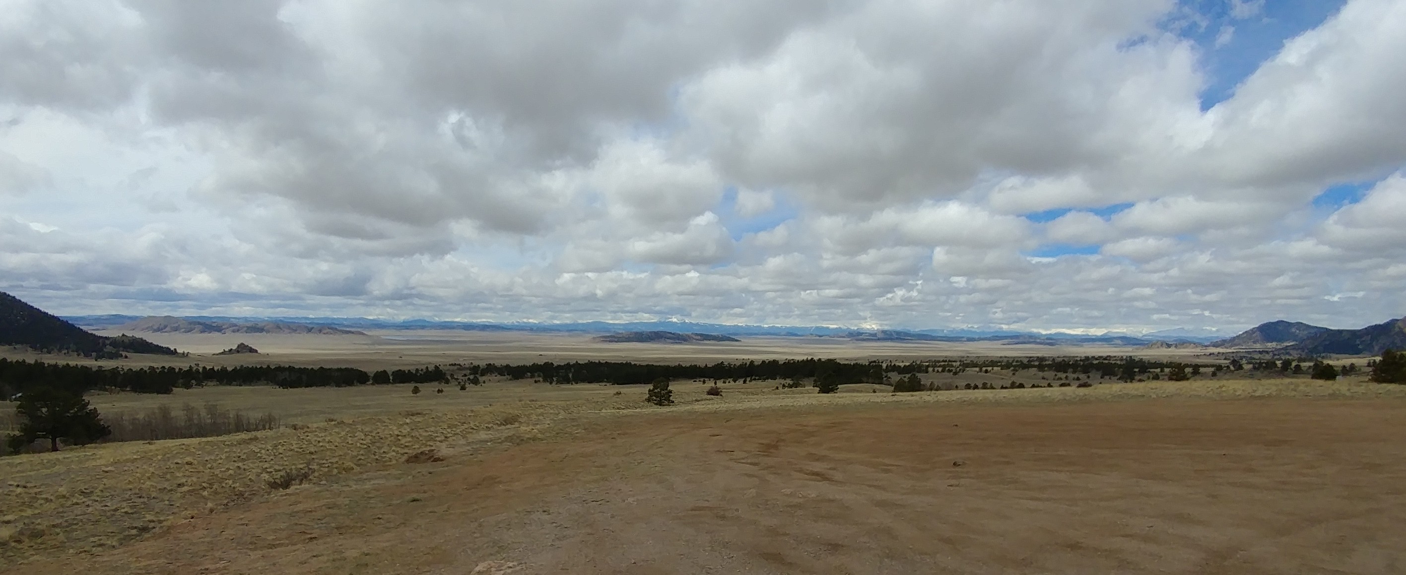
After I-84 turns away from the Columbia River, it heads east and slightly south toward Pendleton, OR. It might have been a good idea, on that 90° day, to stop at the Burger King or Denny’s, or Wal-Mart and watch the people, something long enough to let the engine cool off a while. Perhaps the Wildhorse Resort and Casino in Mission, a few miles further east, if that floats your boat, would have been interesting. But we plowed ahead and started climbing, and climbing, thinking we peaked, and kept climbing, until the engine temperature hit the red mark which causes an immediate upshift in gears and slowdown. Luckily, one of many pullouts was available at the same time so we pulled over and turned off the engine.

A few minutes later a very cool, black Dodge Charger pulled in behind us. I couldn’t see inside his tinted window to see if this was somebody with a gun or a tourist stopping for the view. Turned out to be a dude with a gun approaching us. A very dapper state patrol officer met me as I opened our door and politely asked if we were having trouble, wondering if we had overheated. Upon answering in the affirmative, “Yes. Hit the red zone, just cooling off for a while”, I asked how his day was going. “Trying to keep cool”. As he walked away I asked him to keep an eye on me. Then that very sleek looking Charger kicked up dust and took off. Love that car. I know cops drive a lot of Chargers but this one was completely stealthy. So watch it going up Deadman’s Pass.

It was about seven miles or so to the top of Deadman’s Pass. It was steeper going down, another bump near La Grande, and then a fairly straight run to Baker City. But let’s go back to I-84 on the Columbia River.

A lot of these are pretty similar. The supreme editor prohibits picture taking while driving but I figured a way to snap my eyelids and connect my brain to the camera. I took about thirty million shots. Here’s a few more.

Must be a windy area ahead.

Just driving.

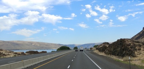
It was lovely the whole river ride.

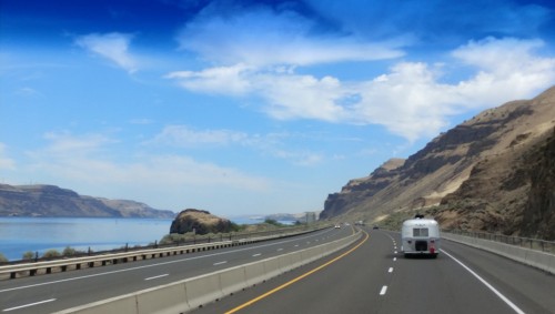
There’s that Airstream again.

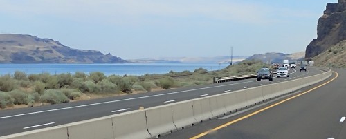
I think we’re getting to the end of the river view here.

Maybe this one’s out of sequence. Do you care?

And that’s it. Southeast on the straight, open road.

After the nasty climb up Deadman’s Pass, we spent the night in A-Frame RV Park in Baker City. The park name is obviously from the office building. It was good enough for an overnight stay.

July 26th
Baker City, OR to Picabo, ID

On the road again. Another 264 miles to a gem of an RV park. We are taking a bit of a side trip to check out Craters of the Moon National Monument in Idaho. I first heard about this place when researching our big trip west in 1998 and it led me to watch the ridiculous Ted Danson movie, ‘Pontiac Moon’. The plot went something like this: his wife, Mary Steenburger, hadn’t left her house in seven years after losing an unborn child in a car accident. It’s the summer of 1969 and Ted decides he has to take his son on a trip to this park, which was called something else in the movie, and arrive the day of the moon landing. They are driving from a small town in California and Ted comes up with a route that will put just the right mileage on his 1949 Pontiac Superchief when it arrives at the park, to equal the distance to the moon. It gets complicated – Mary follows them, Ted has an accident, and the whole movie has long since gone off the rails. But I like road trip movies. I like road trips. No kidding.

Anyway, the choices for staying in an RV park near Craters of the Moon were slim. There is an RV park in the National Monument, but it has no hookups and we wanted electric, at a minimum. The other two that showed up in our searches were in Bellevue, at least ten miles out of our way north (and ten back), and in Arco, about twenty miles east, past the park. But then Google kept showing me Picabo Angler when I searched for RV parks in the area. I looked it up in RV Park Reviews and it was real, with good reviews, Andrea called up along the way and reserved a spot. It is thirty-two miles west of the park on US 20. Perfect.

Another long ride.

But pretty easy.

I think it was on cruise control for a hundred miles.

I liked that farming pattern.

We finally arrived at check-in for the park, Picabo Angler convenience store and gas station, across the main road from the park. There must be some big fishing nearby – could the name of the place be a clue? Half the store was devoted to serious fishing equipment with big signs touting their guide service. The guy ahead of me on line was booking a trip.

Once registered for the RV park, we crossed the road and entered, passing a big sign for Picabo Angler and Silver Creek RV Park. Why don’t they add the RV park to their Google listing? Each site is a beautiful pull-thru with full hookups, just one row of about a dozen sites. Ours was a hundred twenty feet long. All sites have nicely manicured grass and face a large sheep and llama farm.

That’s us. The Cruise America RV on the right was carrying a family from Denmark across the US West. Very nice family. We spoke with them for a while.

Lovely RV park.

Baaaaaaaah. White llama in the back.

And the black llama.

Baaaaaah again.

A hidden gem of a park.

That’s us again.

The Park is right on the road to Craters of the Moon coming from the west. Beautiful setting and convenient. Highly recommended.

July 27th

It’s thirty-two miles to Craters of the Moon. The plan is to get there by 11AM, park in the visitor center lot, detach the jeep, and check out the campground and the park to see if it’s worth staying overnight and exploring more deep into the day. I could tell by zooming in on Google maps that the parking lot had room for the 42′ Odyssey. I only use satellite mode. You gotta love Google maps if you’re an RVer. I use it all the time to see if we can fit in Wal-Mart lots and non-truckstop gas stations, and look for possible large pullouts for rest stops in the middle of nowhere.

The parking lot did have RV spaces but not many. In fact, we got the last one. First we went into the gift shop, one at a time as we brought Luna out to walk around. When Andrea went in, I sat down on a bench in the shade and tried to listen in on a ranger talk about twenty yards away. He was mostly out of my hearing range but I heard a few words about the origin of the park. At the end of his talk, this guy, in the green shirt,

raised his hand, loud enough so I could hear him speak, interjected that what was just presented is just a theory. He went on…Several scientists with PHD’s have formulated another theory that the world is only ~~~so many years old – I didn’t get the number but that’s when I started losing him. I got to wondering if he was armed. People that retarded – and, yes, shoot me for using that term – need to just shut up. Yeah, first amendment and all that but do not poison the minds of young children with total bullshit. When he was done proving to the group what an asshole he is, the ranger proceeded, “For the other 99 percent of us, let’s now take a look at some of the million year old samples in the exhibit.” Right on, young man.

The picture of the idiot, who kind of looks like Peyton Manning (sorry big boy), is out in the parking lot after he accosted a seminar attendee whom he thought might believe his lunacy. The guy kept trying to walk away while six-thousand-year-old-earth-theory-man keeps spouting off about several scientists with PHD’s can’t be ignored. But he can. The other guy walked away as shit-for-brains kept talking to himself. Should I ask a ranger to check him for weapons? As much as I loathe the stupidity of imbeciles like him, I also have concerns that they have gun rights and cults have been known to arm themselves.

What is wrong with these people? They make me lose my sense of acceptance. To each his own? When they are teaching impressionable children that science is wrong? Should we have truth police? Maybe all our national parks and monuments that protect eons old patches of earth which provide insight into the evolution (may I use that word?) of our planet, should have additional plaques and informational boards that state outright that any theory that places the age of the earth under four and a half billion years is false and we should speak up loudly to dispute absurd claims to the extreme contrary. And then provide the argument with evidence from the local environment of the park.

That guy both creeped me out and pissed me off. Count to ten…

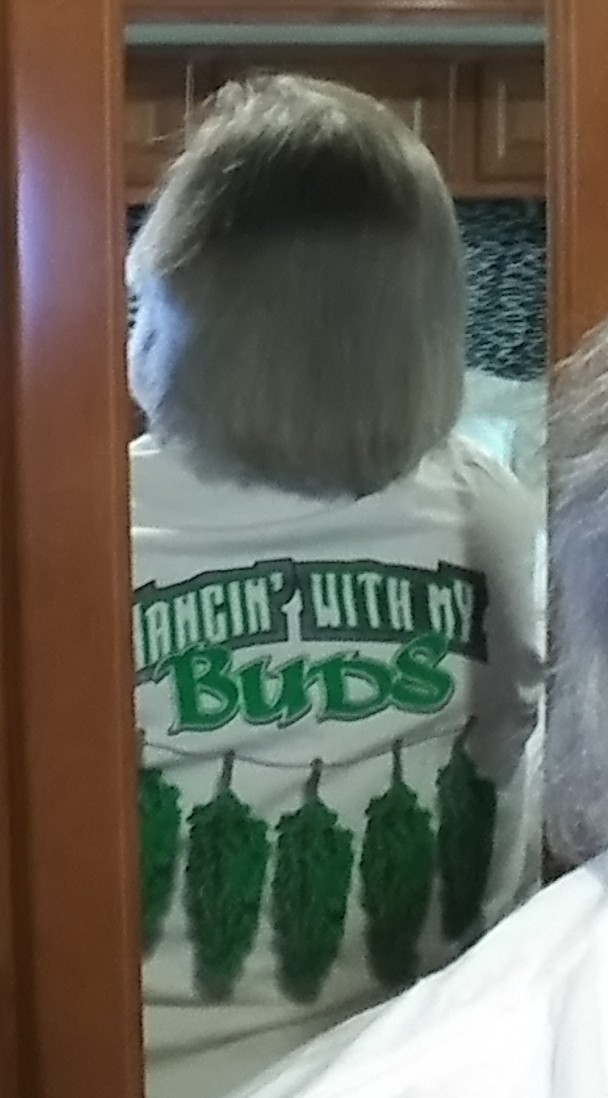
Andrea came out of the gift shop – empty-handed? No. What are the chances of that? She got me a t-shirt! Yay! We detached the Jeep and took the seven mile loop drive. The entire park is just a moonscape of dried up black lava. It is not the result of a volcano, rather just a bubbling up of the stuff when the local plates were shifting and pushed the molten mess out of a few cracks in the surface.

First we drove through the campground and found it to be totally unwelcoming on a warm day, all sites sitting on the same black lava. Hot, hot, hot. No thanks. Knowing we were not going to stay, we knew we now had to expedite the tour.

The first loop stop included a short “hike”. It was actually a quarter mile walk due to closure of most of the trail. There were a few interesting lava formations.

Like this monkey headed lump.

Planet of the apes dude, no? Otherwise, eh.

Next, a large hill that all the tourists except me climbed to get a good view of the park, I guess.

That’s Andrea in the middle, red top, below the pink and green couple. The woman in green looked to be about ninety. She was draped head to toe in that thing. Looked like she was used to these kinds of hills.

We skipped a couple of other stops on the drive. One was the cave section but I was told by a ranger that they involve quite a bit of scrambling (that’s a term used in hiking for climbing over rocks, usually on hands and knees). Not in the cards with the way my stenosis has been acting up, or getting worse. It was all kind of like what it’s going to look like after Dumbo gets in a war with somebody:

Life after death?

The last stop had short paths to two cinder cones.

The first one didn’t look like anything from the approach, but as you turned the corner:

There was a big, deep hole in the ground. Way down below was either a sheet of ice or salt or some white mineral. General agreement between me and the foreign tourists was ice.

The path that curved up and around, rather steeply at the top, led to a cone not all that interesting. The best I could come up with was the somewhat colorful inner wall.

And that was Craters of the Moon. Oh, we encountered some wildlife. On the first walk, a raptor circled above, waiting for one of us to keel over, or perhaps pluck a small child:

When we returned to the parking lot, a monster on the windshield threatened to pincer us to death:

On the road again. We drove through Arco, ID, whose welcome to Arco sign also includes the boast, “First Atomic Lighted City”. We wondered if the three-headed pan handler had also been so energized. About 20 miles east of Arco, the source of all that atomic energy can be found. We passed Idaho National Laboratory (INL) where everything you wanted to know about nuclear energy is known. Though you can’t miss the complex to our left – well, you can because I didn’t aim the camera that way – they seem to be playing it very cool in terms of road signs.

The real reason I took the pictures on this road were for the Twin Peaks. You can think of the old TV series, or the breastaurant chain.

A few miles down the road we arced off US 26 to US 20. Had we stayed on 26, it would have led us to ATOMIC CITY! But we continued to the booming metropolis of Idaho Falls, home of many of the nuclear scientists working up the road. Next time someone says they are from Idaho Falls, give them some space if they have a glowing personality. And, there’s a good chance you’re talking to somebody much smarter than you.

About thirty miles east of the big city, the Snake River meets up with US 20 at the Clark Hill Rest Area. On hindsight, I wish we had stopped there. I immediately saw large nests and bald eagles on telephone poles. No looking through binoculars to identify them. These were the real thing – three on one pole! I started slowing down each time I spotted an abnormality on a pole in the distance. Lots of nests, more eagles. A bit further down the road I slowed enough to stare an owl down. Unfortunately, I didn’t get a picture.

We finally arrived at Palisades RV Park, another we had called while on the road and another where we got the last site. Not exactly a site. It was in the “overflow” area. It was ok for overnight and though the lady was overly nice and accommodating, she still charged us full price, $45. For that, despite her being so nice, I’d recommend staying at one of the other RV parks. I don’t get mad (well, sometimes), I get even.

The RV park’s location is a short walk to the Snake River. That’s one positive for the place. I couldn’t wait.

We got to the river just as the evening mosquito hatch was in full swing. We were breathing them in as we nearly ran back to the campsite. Perhaps the location is not the most ideal. No eagles to be seen either. We hid inside the rest of the night. Mosquitos suck!

Jul 28th

Happy Birthday to me. For this birthday, same as the year I graduated high school, and for those who are guessing, MLK and RFK were killed that year, I treated myself to a somewhat scenic route and a night at The Longhorn Ranch Lodge and RV Park, right on the Wind River. Did you see the movie? The setting, though in winter, would have been fairly close to the Longhorn, but on, perhaps, the Shoshone or Wind River Reservation. However, like a lot of westerns, it wasn’t shot there. Rather, it was filmed mostly in Park City, Utah. The snow is real though. (We haven’t seen it yet. I looked it up. We’ll wait for it on HBO.)

Anyway, the route I selected to get us home in two stops from Palisades RV Park has us going a bit further on US 20 until it intersects with US 89. We take 89 to US 191, but instead of going south on 191 toward the ever-popular Rock Springs, WY on I-80, a shorter route, we head north toward Moran, passing through Jackson and Grand Teton National Park. At Moran, head southeast on US 26 again to Dubois. One night in Dubois, one in Rawlins, and then high tail it back to Colorado Heights in Monument. You ever wonder where that expression, “high tail it” comes from? Well, if you know, good for you. For others, look it up, keep wondering, or remain oblivious.

This is a relatively short drive of 144 miles. But, it is packed with scenery. Right out of the gate – yeah, a horse racing expression – we have to stop at Palisades Dam.

Sorry. That’s all I got. You can see the dam beyond. But the main reason we stopped was because we had a FaceTime call coming in from Bree and Patrick and the cutest grandkids on the planet. Reception was so-so, cutting the call short. Osprey swooped around from the cliffs to our left. More Bald Eagles nested on telephone poles. Worth a stop, call or not.

We drove on and as we approached Alpine, ID, paralleling the bulging Snake River beyond the dam, we saw RV’s hangin’ near the shore.

Alpine, Idaho. Who ever heard of that? If you go back to a post about The Fountain of Youth RV Park on the Salton Sea in California, you’ll recall that I thought it was THE depository for witness protection folks. Having travelled through 98% of the states (sorry, North Dakota, still no reason to visit though you are probably number one on the list), the Secret Service can drop Rick Gates off just about anywhere and he can get lost in the system immediately. Now, if I had a choice, after I release the Pee-Pee tapes, I’d start a new life in San Diego. It’s all about climate.

But, we’re now turning left on US 89 to Jackson, and still following the Snake River. Gorgeous.

I think this is the same picture, zoomed in.

We had lunch there, one of our few, truly beautiful lunch stops. Come on, I know you’ve got lunch stop envy. We listened to rafting groups go by as we had PBJs.

A few miles south of Jackson, a major highway renovation project on US 89 provided me with my first birthday present. The road is in terrible shape. The speed limit drops to 45 but it should be about 20. The vibration on that shitty road was so bad, I got present number 1 – the compressor for the front end air conditioner/heater stopped working. WTF? Did a wire get jolted off? I don’t know. It’s on my to-do list.

Navigating Jackson is fun, at 42′. Streets are tight, but they get out of your way. What a tourist shit-show! If you’re going to visit the Tetons and you hate crowds, avoid Jackson. Book a year in advance and stay in the park or anyplace away from Jackson. But that’s just me. I want the money in my pocket to stay there.

Leaving Jackson, we head north and immediately upon leaving town are drawn to the Tetons to our left, but this plane coming in for a landing is quite the distraction.

The sky was hazy, perhaps caused by western wildfires. The zoomed-in shots were just not worth showing. How about this one from a distance?

If you haven’t been, the Tetons and Yellowstone should be on your bucket list. Book one or two of the lodges at least a year in advance. You can fly into Jackson but look into Bozeman also. Yellowstone is huge, like bigger than Rhode Island, so don’t expect to see it all in three days. If you’ve got some adventure in your bones, and more days, rent an RV in Denver and take the route up 26 to Moran.

Speaking of, at Moran, we head southeast on US 26. Some of that drive is mind blowing. The mountains to the northeast are spectacular. When the road finally straightened out and the speed limit allowed us to get moving, I received birthday gift number two, WHAM! A rock smacked the windshield, passenger side and up pretty high. Scared the shit out of both of us and created a spider crack about two inches in diameter. Calming down, we proceeded to the Longhorn RV park.

Nice place. Spacious sites, some back-in sites right on the Wind River. Negative – some family reunion was going on so there was no peace.

Before calling it a day, Andrea came in and asked why water was flowing out of our outside electric compartment. DOH!

Birthday present number three:

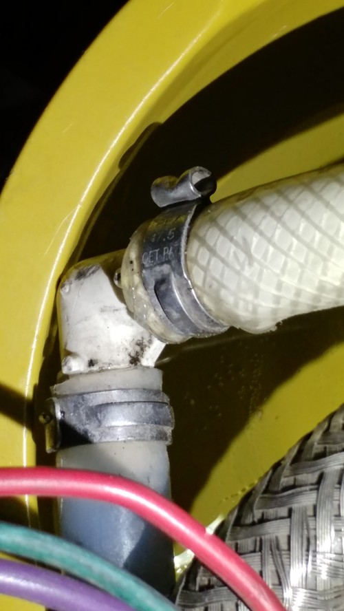
That L-joint is part of the moving rack of wires and plumbing from the bedroom to the rear bathroom. One of the brackets in the immovable section broke and the L-joint started moving too much. That olive-green thing is a bowl. I didn’t uncover all this until we got back. In the meantime, the solution was to turn the water off and open a couple of faucets to relieve the pressure. Turn the internal pump on when necessary – “ok, I need to flush now.” Only one more night to go.

July 29th

Dubois to Western Hills Campground, Rawlins, WY

This is a 198 mile drive. The scenery is what you might think of in a western movie but perhaps a bit more rolling hills. In my mind it is quite beautiful. Sorry, I failed to take a picture. About 40 miles down the road on US 26, you have to bear right onto US 287 toward Lander. It was another 70 miles or so to our rest stop, named Sweetwater Station. Have you seen ‘Once Upon a Time In The West’? One of my favorite movies of all time, set in Kansas as the railroads moved west, filmed in Spain and Monument Valley, starring Henry Fonda as the villain, Charles Bronson, the vengeful hero, Jason Robards, the likeable bandit, and Claudia Cardinale as the love interest. The first scene (Google “Once Upon a Time In The West Opening Scene”) lasts about fifteen minutes and includes two old time western actors, Jack Elam and Woody Strode (first African American professional football player, turned actor), and one of the great exchanges in a western. Elam, Strode, and another toothless bad guy, with their three horses, approach Bronson who just got off a train.

Bronson: “And Frank?” (Referring to Fonda)

Elam: “Frank sent us.”

Bronson: “Which one’s my horse?”

Elam: “Well…looks like we’re… (turns around and smiles at his buddies)..looks like we’re shy one horse.”

Bronson: (shakes his head) “You brought two too many.”

The bad guys get a look of terror in their faces and then all hell breaks loose. Watch it on you-tube. Oh, the movie’s all about the future train stop, Sweetwater.

Rawlins is a truck-stop/oil refinery town along I-80. The campground is a little bit west of the US 287 intersection but it is great for an overnighter. The lady running the place is really nice. The RV park is nothing more than a gravel parking lot with a variety of hookup combinations, mostly pull throughs. All we needed was electric but got a full because of our length (with the jeep).

July 30th

Last leg, 279 miles. This is a long one for us. Avoiding the construction mess in Cheyenne, we take US 267 south at Laramie. That takes us through Fort Collins, a tight drive through the college town, and eventually to I-25 south. At 200 miles, outside Longmont, we rest and I finally get what I’ve been craving for days – two McDonald’s cheeseburgers (no mustard, please – New Yorkers don’t put mustard on hamburgers – and I prefer to pull the pickles out and eat them separately. Shoot me.)

On the road again. Just have to negotiate Denver traffic. One moment of indecision – the RV GPS, loaded with our weight, width and height, wants to route me around the city on 225. The warning message is 11′ bridge! What? I’ve driven this a hundred times. Keep following the other trucks. A mile or so before we get to the football stadium, signs indicate that trucks should stay in the middle lanes. Oh yeah! A couple of overpasses by the stadium are arced and very low at the far left and right. Been awhile. No problem.

Finally. Back at Colorado Heights Camping and RV Resort. Our second favorite site, C29, is available. However, the owner jacked up electric rates to $8 a day. This would be a nice park if it wasn’t right on Monument Hill near the top, elevation 7,343′. Northbound traffic is flooring it. Trucks roar. Southbound, trucks use engine braking which is also very loud. The noise is incessant. Some say they get used to it. White noise. At night, when you go out and look at the stars, it’s always there. This past weekend (Aug 11-12-13) was the peak of the Perseids. We went out the first two nights. Saw at least 10, a couple of real long ones, accompanied by the drone of never ending traffic. That’s no way to look at the stars.

Anyway, that’s it for travels this summer. We’re here to see the kids as much as possible. And get some repairs done on Odyssey. By the way, I replaced the L-joint but had to buy a $45 crimping tool for the job. I hate plumbing problems.

Have a good rest of the summer. If we take any good day trips, I’ll be in touch. Otherwise, looks like Gold Canyon, AZ will be the next destination in October.

If anyone has a question about any of the places we’ve visited, or you’d like to discuss politics, religion, or the meaning of life, email me at bjcarlin71@gmail.com.

One more thing – Dr Ford, the shot was not effective.

Portland and the Columbia River Gorge: 7/22-7/25/18

This is it! The last sightseeing stop on the great west coast odyssey. Did you ever get to the end of a 10 day vacation where you’re out doing something everyday and think you need to take a break from vacationing? Try 122 days, about 4,000 miles driving a behemoth, and another 5,000 touristing. What? OK, I checked. More like 7,000 on the Jeep and, no, the odometer is disengaged when towing, all driving.

We’re now in Portland Fairview RV Park. The RV park is one of those Thousand Trails “Collection” parks with a $20 surcharge. The location is pretty good on the east side of Portland, just a few miles from the scenic byway through the Columbia River Gorge. Nice park, well maintained. Sites in the upper section, which is where they apparently put the transients like us, are not very big. We fit, just barely. All concrete pads with a separate pad for your toad – that would be towed (vehicle). Mowed, green grass between sites, each with its own small street lamp with your site number on it. The lower area – it is pretty steep going down to the trash dump, just as nice, seems to have more of the long-term campers. It is one of the best parks we’ve stayed at during the journey. We didn’t spend much time there. We’re tourists!

Monday morning and we were out on a waterfall tour along the river, following the Historic Columbia River Highway. First stop, Portland Women’s Forum State Scenic Viewpoint. Really? An overlook that needs six words? Come on, man, or women! This is looking east.

You see that house on the cliff to the right? That’s the next stop, Crown Point State Scenic Corridor. What? Only five words? Well, it had better views. In truth, those long names are what you find on Google maps. They are a little shorter in reality. This view is looking back to the west (the east view wasn’t much different than the first pic if you crop out the cliff).

Luna was just loving yet another tourist ride:

NOT!

How about a little history about the making of the gorge?

Millions of years in the making. Any lunes out there doubt that? More on that in the next post.

Then it was on to Latourell Falls, and Multnomah Falls, and Bridal Veil Falls, and this falls and that falls:

Actually, those are shots from Latourell Falls, the skinny waterfall, and the others from the bridge across Multnomah Falls. Here’s one more from Latourell.

Some people just like to get wet.

This is from Bridal Veil Falls. I thought it was cool enough for its own place here.

Unfortunately, the Historic Columbia River Highway is undergoing major restoration from Bridal Veil Falls east to its termination in Dodson. We missed a couple of falls. To get to Multnomah Falls, the big one, you have to get on the interstate going west for one exit and turn around eastbound.

So, onto Multnomah Falls. It is right on Interstate 84. It has its own exit! And restaurant, and gift shop, and parking lot big enough for busses! Arrgh! Another billion people! The shots in the collage are from a bridge across the lower part, so you’re not seeing it all. If you must see it, you’ll understand why I wanted to leave this photo out, even though it shows its enormous beauty. Wonder if I could clean it up using one of those apps to remove photobombers.

Don’t you just want to be Alec Guinness in ‘Bridge Over The River Kwai’ and hit the plunger (he fell on it, last breath, “What have I done”) on the detonator and blow those waving fuckers off? (Where does this rage come from?)

There are at least three falls you can see from I-84. Pretty cool but kind of a road hazard as well. Then we went out to the fish hatchery at Bonneville Dam. Kind of cool and they allow dogs. But, by this time, the falls had exhausted my phone’s battery. I also discovered that the two port USB car charger was only working in one port. Not only that, though my phone indicated it was working, in fact it was draining my battery with Andrea’s plugged in the other port. When you can look at the percentage remaining go down with it plugged in, you know something’s wrong. Switching ports proved the theory. Science at work. (I just got a notification from Amazon that the 40 watt, dual 3.0 port sucker was delivered). That problem has bugged me for months. But I tangenticize…

Anyway, the fish were cool to look at. It would have been cooler to drop in a line in the pond of giant rainbow trout. They also have a large, below pool level window where you can see Herman the Sturgeon, a ten foot monster. Great place for kids and dogs. And Big Foot:

Funny, as I was sitting outside the gift shop with Luna, this very attractive, young woman and her daughter sat down across from us. She kept looking over and I thought, “I still have it!”. Andrea came out of the shop with a bag full of kids booty and then the woman approached. She said, “May I take your husband for a night?” Wait! I’m told that’s not what she said. Oh hell, I can dream. She said her mother has a dog that looks just like Luna and could she take a few pictures? I suppose if she approached me alone, I would have thought that to be a great pickup line. You hear that, you young singles? If you don’t have a pet as part of your repertoire, your mother or grandmother might, and might want a picture of one like hers. But be prepared to buy one for her if the line works!

The next day we attempted to find a stream to go rockhounding. We ended up near Mt Hood.

We found a stream under a bridge:

Luna and I had the shit scared out of us every time a car passed overhead. Andrea had fun,

but didn’t find much of anything.

On the drive out, we had to stop to take a look at this and wonder what it was doing there, right in the middle of the deep forest, with no one around:

So I looked it up. Columbia Helicopters started out as one guy, Wes Lematta, in 1957, and one helicopter doing odd jobs. The fleet grew and in 1971, they were the first in “heli-logging”. Now they have dozens of copters here and in New Zealand. They advertise themselves as leaders in heavy lifting but do all kinds of things. The one you see above, N191CH, a Boeing 107-II, has been in the movies. Have you seen ‘King Kong Lives’? Yes, the helicopter hauling away Kong was the one above. Kind of fun to find out stuff like that when you dig. Some of their others have also starred in ‘Runaway Train’, ‘Under Siege’, ‘Demolition Man’, ‘The Lost World: Jurassic Park’, and ‘X2: X-Men United’. So how about that?

While I’m out on that tangent, let’s branch off again. You ever wonder what those numbers on the side of flying machines mean? Like N191CH? They are the radio call numbers/letters. And did you ever notice that the numbers on all US airlines, that is, all aircraft registered in the US, start with N? It was agreed upon in 1919 in an international meeting of aviation folks that the US would use N for aviation radio call signs. We also were awarded the arbitrary W and K for radio/broadcast stations. Why N? The Navy had adopted it as a standard on ships in 1909, so why not aircraft? At international airports you might see plane numbers starting with C-Canada, G-Great Britain, F-France, Germany – sorry, you lost the first war so you can go with D for Deutschland, or those late to the show, J2-Djibouti. The rest of the numbers are up to the airlines, or private plane manufacturers. Southwest has some numbers to honor people, mostly employees. One for a non-employee is N289CT, for Charles Taylor, mechanic for the Wright Brothers. And N191CH? Well, don’t know about the 191 but, CH is clearly for Columbia Helicopters.

Did we have fun out there? If you have interest in such aviation information, these links are interesting:

https://www.faa.gov/licenses_certificates/aircraft_certification/aircraft_registry/aircraft_nnumber_history/

https://en.m.wikipedia.org/wiki/List_of_aircraft_registration_prefixes

https://crankyflier.com/2014/10/16/everything-youve-ever-wanted-to-know-about-us-airline-tail-numbers-part-1/

Remember when you used to get stoned and go out on those tangents, and one story would lead to another and then…what was I talking about? Oh, you still do. Come on back.

We’re back leaving Mt Hood. As we left the forest road and got back on US 22 west to Portland, I was reminded of the good old days:

I preferred EZ-Wider (after blowing my monthly GI-bill educational check on a big brick), or perhaps an Esmeralda (remember the dragon on the package?) for a party (sometimes of two). But Zig-Zag would do in a moment of personal introspection with headphones on, examining passages from ‘I and Thou’ or ‘Us and Them’, or perhaps contemplating eternity, the weird scenes inside the goldmine of your mind, the shredding of ego – or was it the shredding of my eardrums during ‘Dazed and Confused’?

Returning to the present, and Portland, the great west coast odyssey comes to an end.

We saw a bunch of mountains along the way:

And met some new friends:

Now we have about twelve hundred miles to go to get back to Colorado to see the kids.

Some notes from above ground and pics from the road to follow.

Puyallup, WA: 7/15-7/18/18; Randle,WA: 7/18-7/22/18

pew-AL-up, but I prefer Pile-up. We saw a nasty one on interstate 5 right next to Camp Murray, some military thingie. At least five cars involved, one crushed, and then four screaming ambulances, but only an hour wait for us. We were about a mile behind when it happened. How the fuck does that happen? Beautiful weather, traffic moving along just fine, then BOOM! Gotta be some asshole fucking around on their phone. Or just idiots who shouldn’t be allowed to drive. Pay attention douche-bags! You’re doing 70! It’s just so sad that good driving innocents get caught up in stuff like this. Just back off jack-off! Tailgaters are a pet peeve of mine. Wish I had a small canon that would automatically pop out from the trunk when some jerk crawls up my ass – and fires at the shithead! Get those fuckers off the road!

Sorry. I drive a lot and see all kinds of dumb stuff from up at the trucker’s level. When somebody gets killed on the road on any kind of day, unless it’s a tailgater who fulfills his Darwin Sanction, it pisses me off. Could you tell? (Counting to a thousand and waiting for the editorial staff to get on my ass for using Joe Pesci character language.)

In Puyallup, we stayed at the Washington State Fairgrounds RV Park. Very nice park, as are most fairground RV parks. They’re usually cheap, have full hookups, and generally close to whatever it is you came for. I don’t know if that makes sense but where else can you stay within 35 miles of the Pike Market Place in Seattle for $30 bucks?

And eat good chowder

It was ok

But not worth standing in line for twenty minutes. If you want the best chowder in America (as per the panel of judges on our extensive editorial staff), go to Florence, Oregon and head into the Old Town area to the large public parking lot. On the first dock you’ll see a small shack. Go there. Skip all the expensive restaurants.

Andrea saw the lobster roll on the menu and loved it. Wait, it was Dungenous Crabs.

The big thing in the marketplace is to watch guys throwing fish. And people posing with squid. WTF? After the first ten seconds among twenty billion tourists, I could give a shit about guys throwing fish. Guys throwing up might have been more entertaining. Besides all the fish stores, there were three hundred produce shops, two hundred and fifty niche gift shops, and a few hundred more places to throw your money at. And twenty billion tourists. I just loved it.

The second day in Pile-Up we went to a bead store near Tacoma with the largest collection of beads in the world. I didn’t go in. When she came out, Andrea told me they had a whole entertainment area for the men-folk who don’t find beads all that interesting. They had pole dancers who only wore beads. Cool huh? If only.

The horrendous traffic accident occurred on the ride back. It was pretty awful.

And then we were off to Randle, Washington, a handful of gas stations/convenience stores and the Cascade Peaks RV Park on US 12. The rustic, in the woods, section of the park looked…, well, just great for tent campers. We were directed to the part alongside the highway, for big rigs, and it was fine. A bit weird in that each electric box was centered for the four sites around it and only one of which was 50 amp, the other three 30 amp. We chose a site with no others sharing the box but the 50 amp outlet didn’t work. Overall, it was kind of a dumpy place but good enough for two nights and a great location. US 12 runs east/west (did you know that east/west routes are even numbered and north/south odd, mostly?), south of Mt Rainer’s Paradise entrance and north of the Windy Ridge viewpoint to Mt St Helens.

On Thursday, July 19th, we went to Paradise.

It was clear around the mountain for a short while. Check out all the snow and ice. (At 14,410′, it is almost the exact same height as Pike’s Peak. We just got back to Colorado and Pike’s Peak is bare. You can’t tell from the picture perfect weather we had throughout the northwest, but wow, they sure get their share of precip. Sorry, I’m way behind on these posts.)

If you are on just about any elevated level in the southern Seattle area, Ranier towers above everything, provided it isn’t shrouded with clouds.

The whole drive in was very scenic.

But, again, too many tourists at the visitor center, and major overlooks. We WERE very impressed with all the bicyclists. Kudos to all you crazy people.

On Friday we were off to the volcano. Actually, the northwest is littered with volcanos. They’re all going to blow again one of these days.

The drive to the Windy Ridge overlook,

the closest you can get driving to Mt St Helens, is on forest roads and sometimes, as with life, the journey is the thing.

That little piece of road just seemed worthy of a stop. As we started rising in elevation, we thought, at first, we could see Ranier from one of the overlooks.

Wrong. Mt Adams. From that vantage point, three big peaks are visible, on a clear day. We had yet another perfect day. Mt Hood is the pointy one far in the distance though it doesn’t photograph well from that distance. Zoom in on the info-board below.

And the third volcano from that overlook, Mt St Helens:

The next overlook gave us a peak at Spirit Lake, and a shoreline of logs.

Next, a better look.

Some facts?

Windy Ridge really doesn’t give you as good a look at the big, bad volcano than the earlier viewpoint.

However, the ridge was aptly named and the flowers were blooming.

It was so windy up there that they set up a few huge panels of plexiglass in front of a small amphitheater where, one might assume, rangers present the story of the volcano. One might have doubts about current presentations when you see the condition of the plexiglass.

Without the plexiglass:

The good thing about driving back on the same road you came in on, as opposed to loop drives, is that the scenery looks different from the opposite direction.

First, the devastation was clearer but so was the emergence of new life.

Remember, the blast occurred twenty-eight years ago. Some trees are pretty healthy now.

One last look at Spirit Lake, Harry R Truman’s grave.

And some views we missed going in:

One more:

A bit less awesome than Ranier but way fewer tourists. For you RVers with big rigs, the Cascade Peaks RV Park is a perfect mid point to see both attractions. Just don’t expect much of your rv park experience. You’ll be out touristing most of the time anyway. On the way back from Paradise at Ranier, stop at Cruiser’s Pizza in Packwood and be nice to the counter lady. She kept a smile on in a madhouse on a Friday evening. The pizza was just ok but, hell, it ain’t New York.

See y’all in Portland.

Grandy Creek RV Park, Concrete WA – Part 1 – 7/12-7/15/18

North Cascades National Park has been high on my bucket list since well before the Morgan and Jack road show. Prior to 1997 though, I don’t believe I’d even known the park existed. Do they teach kids today the whereabouts of our National Parks and Monuments other than the Grand Canyon or that tricky one, Yellowstone? I didn’t know much about them until I was 47, so either they didn’t teach that piece of geography in the sixties or those memory cells were deemed to be re-usable along the way. Our Social Studies class, or was it Geography?, in NY, must have offered more than General Grant’s Tomb, a national something (Historical Site), and the Statue of Liberty, a National Monument. For a long time I wondered how any other national monuments, other than the Washington Monument, which I learned later was actually a National Memorial Park, and the Statue of Liberty, could be called a National Monument when they didn’t have a standing, man-made structure, you know, like a big gravestone or or a giant green statue holding a torch. Such was the interest of a kid from Brooklyn.

So what makes Yellowstone tricky, geographically speaking? You know, like where is it? OK, here’s a clue in a question. What do Yellowstone National Park, the Glen Canyon National Recreation Area, Dinosaur Natonal Monument, and Smoky Mountain National Park have in common? (Other than that they are administered by the National Park Service.) Mull on that, or cheat and Google them. I’ll bet most of you east coast folks didn’t even know there was a Dinosaur National Anything.

In 1997, specifically Labor Day weekend in Albany, NY, a switched turned on in my head and I began research into and planning of The Big Trip. The following June we flew out to Las Vegas and embarked on a 2,200 mile trek, a circular route from the Hoover Dam and the Grand Canyon through southern Utah, western Colorado, and back through all five national parks in Utah, over sixteen days. As part of the preparation, I bought one of those National Parks books. I was rather awestruck at the photos of North Cascades National Park, one I had never heard of. I put a bold checkmark on those memory cells.

When we started talking about this west coast adventure, North Cascades had to be in the conversation. Rarely does the anticipation match up with the reality, and I had been hyping this place for twenty years, but, it is as advertised, stunning. It is the least visited of all our National Parks, mainly for logistical reasons. One road, US 20, runs through the park. It is 133 miles from the Seattle-Tacoma airport to the visitor center in Marblemount. It’s another 43, jaw dropping miles with a few spectacular overlooks, to the Washington Pass Overlook, and another 32 miles to civilization, the small town of Winthrop where you can stay. You could drive another 180 miles east to Spokane, or drive back to Seattle and see the park going west. It’s kind of big for a one day trip. So people skip it. Don’t, if you come to Seattle.

We stayed in Grandy Creek RV Park, a weird kind of place – half Thousand Trails and half KOA, in Concrete, WA. Actually, it was about eight miles west of the actual town, and its 2,500′ airstrip. More on that later. Nice park, most sites are treed so satellite dishes only work in a few. We had a spacious back-in with full hookups, but just 30 amp electric, which limits your electrical usage at times and, we’ve found, doesn’t provide enough oomph to our clothes dryer. Other than the choose-your-own-site policy, which I detest, no complaints about the park. Well, the KOA side had some function extend beyond the quiet hour on Saturday night, and they were loud, but I’m ok with people having fun.

By the way fuck Trump and …..(editor’s redaction).

Onto the National Park. Before we even entered the park, we stopped at a roadside park in Rockport alongside the Skagit River. An interpretative board included information on Bald Eagles in the area. Sorry, they only come around in the winter, but when they do, it’s by the hundreds. In fact, Concrete celebrates their return every weekend in January providing volunteers at multiple sites along the river who help with spotting and enjoying the spectacle. The eagles come for the adult salmon population that runs upstream in the fall, actually, their carcasses, when they run out of gas. I would love to come back some January. Anyway, the surprise for us was the view to the east, into the park:

After stopping at the visitor center in Marblemount, where – can I say this without the PC bullshit? – a cute Park Ranger pointed out the most scenic points on the drive and when I asked if it was worth driving to the Washington Pass, she asked if I was asking to be convinced and that was an easy yes. She asked if I liked looking at jagged mountain peaks and I said, sign me up. But first, the waterfall at the power plant at Marblemount:

Not bad for a trail carved out by the power plant.

With the right angle of the sun, its own rainbow:

Give them some credit. They even installed colored lighting on the trail and the waterfall along with music for the night time visitors.

And then off to the mountains, and through them.

Ok, let’s just bag the commentary (other than any keyboard entry to put the photos in sequence – otherwise, WordPress randomly fucks with them.

A few dams along the way created lakes.

It just kept getting prettier.

Roadside waterfalls were plentiful.

And large:

Actually, that’s underneath a bridge, the remains of a skinny waterfall, leading to the Skagit River.

Another overlook:

Now to the north:

And now deeper into the park:

Walking out to the middle of that road to the left:

It was like that for miles. “Look at that!”, every minute or so,

as the road turned.

At this stop we neared the Pacific Crest Trail.

Finally, we made it to the Washington Pass Overlook.
Ready?

No photoshopping. The low sun in the sky created those colors.

Some big views, depending on what part of the mostly railed trail of the overlook path you were on.

Here’s one I touched up a little, showing the railing.

It was a place you could hang out and marvel at this stuff for hours.

I would love to take that drive again in, perhaps, May, or the earliest US 20 opens – it closes for the winter, to see more snow capped peaks. As it was, we had perfect weather, a rarity in this part of the country. It has been like this, if not a bit hot, for weeks. Karma, baby.

I can’t add any more photos to this email to Carlinrv.com because of size issues, even after using a size-reducing app to cut them down over 50%. So, day two of our stay in Concrete provided a nice surprise. More good Karma.

Oh, back to the question, what do Yellowstone National Park, the Glen Canyon National Recreation Area, Dinosaur Natonal Monument, and Smoky Mountain National Park have in common? They each have borders over multiple states. Yellowstone, most of which is in Wyoming but also overlaps Idaho and Montana. Glen Canyon, which includes Lake Powell, spreads over Utah and Arizona. By the way, if you ever go there, do not miss, and I cannot stress this in the highest of bucket list terms, the short hike to Antelope Canyon near Page, AZ. Dinosaur National Monument is mostly in Colorado but the big quarry is in Utah. Lastly, Smoky Mountain National Park is in North Carolina and Tennessee.

Grandy Creek RV Park, Concrete WA – Part 2 – 7/12-7/15/18

We had no clue that we’d be in Concrete on the day of their Annual Vintage Aircraft Fly-In, nor that they even had an airport. With about a hundred hours as a private pilot (before buying a house and thus the funds to continue the hobby), airplane events hold a special interest for me.

Andrea too. She took lessons up to the point where the instructor told her he was getting out and she could continue her touch-and-goes on her own. She asked, “You mean you think I can land this by myself?”. Yes. “That’s all I wanted to hear. We’re done.” And her flight training was over. She just wanted to make sure that if I keeled over at the controls after a turkey sandwich with bad mayonnaise that she could land it. We have a lot of good flying stories.

So here we are in Concrete, Washington with loads of like-minded people. At least when it comes to flying. <Editor’s redaction> And that’s all I have to say about that! This is about flying small planes.

That sleek one on the left is a beauty. The other one ain’t bad either. Nice setting too.

Words to keep WordPress from randomly throwing them out on the screen.

Too lazy to edit the files on the website.

Fun, huh.

Just too cool hanging out on the runway.

With other flyers.

Makes me want to get back up there.

There’s life after RVing. Maybe in one of these.

Where else, except for hundreds of little airports across the country, can you walk across the runway and see this:

If you live anywhere near one like this, look for notices about fly-ins or air shows. You’ll love it.

Good night.

Beachwood Resort, Birch Bay, WA – 7/6-7/12/18

Their sign says Five-Star! Five-Star what? Another very old RV park with the only upgrades being a handful of 50Amp sites buried so deep in trees you need a Thai Seal team to find them. Again, find your own site. No reserved sites. That’s a ridiculous way to operate. You end up with truck campers and those stubby little bubbles about the same size as Haystacks Calhoun filling up the huge sites and monsters like us in sites only Twiggy could comfortably fit in. A totally outdated concept. After those dozen or so large sites, most of the other full hookup sites are face-to-face, that is, one RV pulls in from the east side, one from the west so you share your “camping area”. That’s great if your neighbor is family, or you’re both swapping couples. The sites are so close, you both can’t put out your awnings but if you have slides and into that swapping thing…., oh, nevermind (editor redaction).

One more note for you RVers, sewer hookup is in the far rear so don’t pull in any further than getting your rear end out of the road. Sites are ridiculously narrow for large RV’s. Another bad Coast To Coast park. Hey Mr. Profit, your parks suck.

On the bright side, we had enough distance between ourselves and the towering trees to the south to see the DTV satellites. This far north, just a few miles from the 49th parallel, the dish needs to “see” 31° over the southeast horizon. That was about the only positive about the park, and location near the border.

New subject. Hey, we’re still exploring the West Coast and on the very bright side, have made it to our northernmost RV destination, Birch Bay, Washington.

Cute little tourist town with one road along the bay and lots of parking so you can get out and take pictures – and find pretty rocks on the beach. There were several restaurants on the strip and decided this was the town to go out to dinner for some crab. Andrea wanted Crab Louie and The Beach had it. We got to the restaurant at about 6 on a Saturday night. Turns out a band had been playing since 3pm. We sat down outside on the front deck but could still hear the band well enough to catch the end of a kickass version of ‘Bohemian Rhapsody’. Are you kidding me? Then they banged out Led Zeppelin’s ‘Rock and Roll’. We had to get a little closer. We moved our table around the corner so we could at least see the band.

No, I don’t see them in this shot either. Then they did two stinkers and said goodnight. “Local bands are like a box of chocolates. You never know what you’re going to get.” Sage words from the 20th century’s greatest philosopher.

Hello! Can we please have dinner? Karaoke is about to begin. Their computer went down and everybody’s orders got screwed up. The people who sat down next to us a half hour after we got there had dinner and when their check was lost, were told, “It’s about $35.” Our dinner finally arrived and Andrea had trouble finding the crab in her Louie. They were out of the local porter beer so I settled for a red, which was very good, to go with my chef’s salad. You can’t screw that up. All in all, it was worth it. The band had its moments, if they’d only stick with the heavy stuff.

Then the sun set.

Take a look to the left of the tip of the bay. Beyond lies a piece of land hanging in a peninsula off Canada. Stop now, if you’re not driving, and Google “Point Roberts”. If you haven’t read the Wikipedia page yet, briefly, after the War of 1812, it took some time to finally settle the northern boundary of the 49th parallel between the US and Canada. But that left a little piece of a peninsula in British Columbia hanging under that dividing line. Point Roberts is part of the state of Washington with its northern boundary being Canada and the rest of it hanging out in The Straits of Juan deFuca. They have their own border crossing and all the bullshit that goes with it.

Speaking of border security guys, —no, the editorial staff says don’t. How about: “Dear Canadian Border Patrol, please put a sign above the booth of an officer in training.” All the other lines progressed at a rate of about eight cars to our one. It was frustrating.

So, despite first impressions at the border, we proceeded to our northernmost driving destination on this entire journey, Burnaby Mountain Park, at Simon Fraser University, latitude 49.2792. Anyway, the location is northeast of Vancouver, BC. It was stunning. Besides the views,

and the views,

and the views,

the main attraction was this:

Can you read that?

If not, Google it.

Next. We went back to Birch Bay the next day and found more colorful rocks. It was too far to Vancouver to drive there on consecutive days. But, The Day After – did you see that made-for-TV movie about when they finally pushed the button? Maybe you should watch it after Dumbo’s latest performance – we went back through the city to Stanley Park. We had heard so many good things about Vancouver being so beautiful that we had to check it out. For a city, I guess. We were underwhelmed. Maybe the hype was too much. But let’s not focus on the traffic and the inner city looking like every inner city.

Stanley Park is beautiful, surrounded by water with a seawall path all around and dog friendly. We parked near a big marina,

a Navy and Marine training base,

and some hokey, made-for-the-park totem poles:

I cropped out all the tourist heads. Perhaps they belonged. These things seem to mock the tourists.

It is a very active port. Here we see a ship coming in to pick up that load of hair dye for the US Oragutan-In-Chief.

Lots of stuff going on.

And lots of seaplanes.

We did see some wildlife. Some ducks. Wait, Canadian Geese. How about that!

And then back to that hoity-toity marina – that building with pink tinted glass was cool.

But you can keep your big cities.

This ends the northbound journey that started on Interstate 5 in San Diego, about 2,200 miles ago in March. But the trip ain’t over yet. Bucket list number 3, yep, that high, is still to come.

And then, July 16, 2018, we hear the Traitor-In-Chief say he’d rather take the word of the former head of the KGB then the work of all our own security forces.

My reaction was, inexplicably, in a foreign tongue, “§¥Ωθฯ₩”. I think that’s Russian (those horizontal lines indicate the phrase is filled with anger) for “You fucking idiots.” Come on, hold up your hands, Trumpty-Dumbsters. You fucked up.