Monthly Archives: July 2018

Grandy Creek RV Park, Concrete WA – Part 1 – 7/12-7/15/18

North Cascades National Park has been high on my bucket list since well before the Morgan and Jack road show. Prior to 1997 though, I don’t believe I’d even known the park existed. Do they teach kids today the whereabouts of our National Parks and Monuments other than the Grand Canyon or that tricky one, Yellowstone? I didn’t know much about them until I was 47, so either they didn’t teach that piece of geography in the sixties or those memory cells were deemed to be re-usable along the way. Our Social Studies class, or was it Geography?, in NY, must have offered more than General Grant’s Tomb, a national something (Historical Site), and the Statue of Liberty, a National Monument. For a long time I wondered how any other national monuments, other than the Washington Monument, which I learned later was actually a National Memorial Park, and the Statue of Liberty, could be called a National Monument when they didn’t have a standing, man-made structure, you know, like a big gravestone or or a giant green statue holding a torch. Such was the interest of a kid from Brooklyn.

So what makes Yellowstone tricky, geographically speaking? You know, like where is it? OK, here’s a clue in a question. What do Yellowstone National Park, the Glen Canyon National Recreation Area, Dinosaur Natonal Monument, and Smoky Mountain National Park have in common? (Other than that they are administered by the National Park Service.) Mull on that, or cheat and Google them. I’ll bet most of you east coast folks didn’t even know there was a Dinosaur National Anything.

In 1997, specifically Labor Day weekend in Albany, NY, a switched turned on in my head and I began research into and planning of The Big Trip. The following June we flew out to Las Vegas and embarked on a 2,200 mile trek, a circular route from the Hoover Dam and the Grand Canyon through southern Utah, western Colorado, and back through all five national parks in Utah, over sixteen days. As part of the preparation, I bought one of those National Parks books. I was rather awestruck at the photos of North Cascades National Park, one I had never heard of. I put a bold checkmark on those memory cells.

When we started talking about this west coast adventure, North Cascades had to be in the conversation. Rarely does the anticipation match up with the reality, and I had been hyping this place for twenty years, but, it is as advertised, stunning. It is the least visited of all our National Parks, mainly for logistical reasons. One road, US 20, runs through the park. It is 133 miles from the Seattle-Tacoma airport to the visitor center in Marblemount. It’s another 43, jaw dropping miles with a few spectacular overlooks, to the Washington Pass Overlook, and another 32 miles to civilization, the small town of Winthrop where you can stay. You could drive another 180 miles east to Spokane, or drive back to Seattle and see the park going west. It’s kind of big for a one day trip. So people skip it. Don’t, if you come to Seattle.

We stayed in Grandy Creek RV Park, a weird kind of place – half Thousand Trails and half KOA, in Concrete, WA. Actually, it was about eight miles west of the actual town, and its 2,500′ airstrip. More on that later. Nice park, most sites are treed so satellite dishes only work in a few. We had a spacious back-in with full hookups, but just 30 amp electric, which limits your electrical usage at times and, we’ve found, doesn’t provide enough oomph to our clothes dryer. Other than the choose-your-own-site policy, which I detest, no complaints about the park. Well, the KOA side had some function extend beyond the quiet hour on Saturday night, and they were loud, but I’m ok with people having fun.

By the way fuck Trump and …..(editor’s redaction).

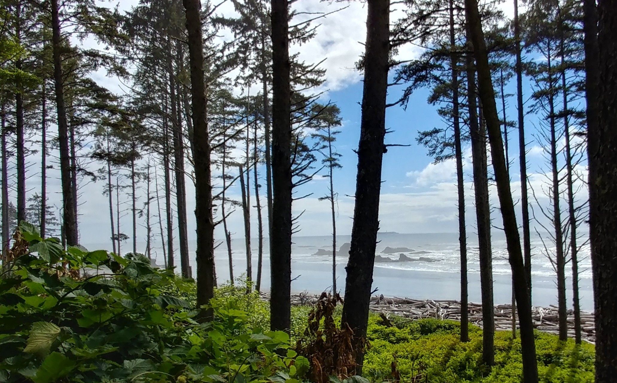
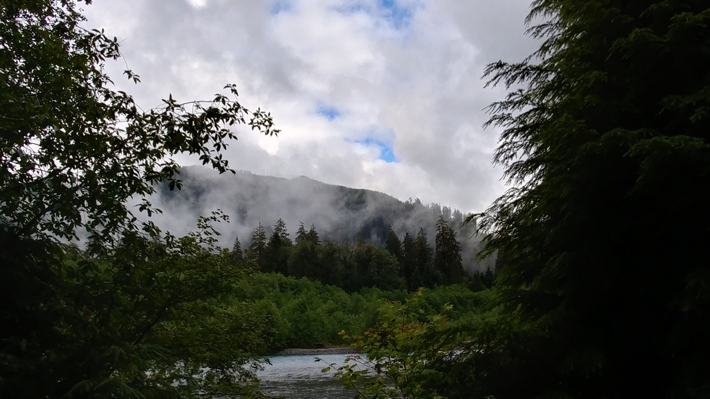
Onto the National Park. Before we even entered the park, we stopped at a roadside park in Rockport alongside the Skagit River. An interpretative board included information on Bald Eagles in the area. Sorry, they only come around in the winter, but when they do, it’s by the hundreds. In fact, Concrete celebrates their return every weekend in January providing volunteers at multiple sites along the river who help with spotting and enjoying the spectacle. The eagles come for the adult salmon population that runs upstream in the fall, actually, their carcasses, when they run out of gas. I would love to come back some January. Anyway, the surprise for us was the view to the east, into the park:

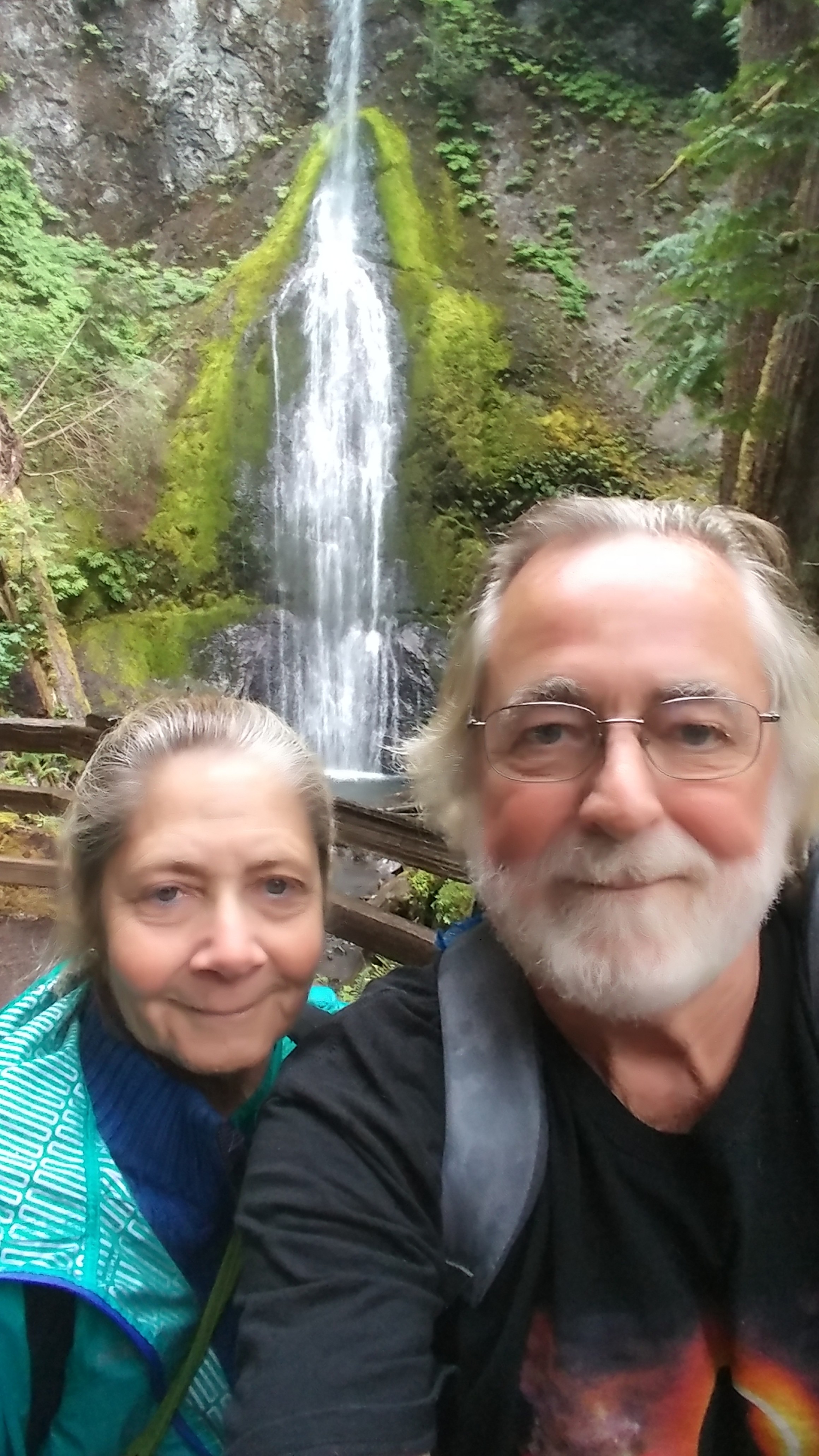
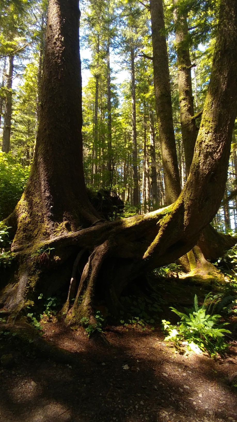
After stopping at the visitor center in Marblemount, where – can I say this without the PC bullshit? – a cute Park Ranger pointed out the most scenic points on the drive and when I asked if it was worth driving to the Washington Pass, she asked if I was asking to be convinced and that was an easy yes. She asked if I liked looking at jagged mountain peaks and I said, sign me up. But first, the waterfall at the power plant at Marblemount:

Not bad for a trail carved out by the power plant.

With the right angle of the sun, its own rainbow:

Give them some credit. They even installed colored lighting on the trail and the waterfall along with music for the night time visitors.

And then off to the mountains, and through them.

Ok, let’s just bag the commentary (other than any keyboard entry to put the photos in sequence – otherwise, WordPress randomly fucks with them.

A few dams along the way created lakes.

It just kept getting prettier.

Roadside waterfalls were plentiful.

And large:

Actually, that’s underneath a bridge, the remains of a skinny waterfall, leading to the Skagit River.

Another overlook:

Now to the north:

And now deeper into the park:

Walking out to the middle of that road to the left:

It was like that for miles. “Look at that!”, every minute or so,

as the road turned.

At this stop we neared the Pacific Crest Trail.

Finally, we made it to the Washington Pass Overlook.
Ready?

No photoshopping. The low sun in the sky created those colors.

Some big views, depending on what part of the mostly railed trail of the overlook path you were on.

Here’s one I touched up a little, showing the railing.

It was a place you could hang out and marvel at this stuff for hours.

I would love to take that drive again in, perhaps, May, or the earliest US 20 opens – it closes for the winter, to see more snow capped peaks. As it was, we had perfect weather, a rarity in this part of the country. It has been like this, if not a bit hot, for weeks. Karma, baby.

I can’t add any more photos to this email to Carlinrv.com because of size issues, even after using a size-reducing app to cut them down over 50%. So, day two of our stay in Concrete provided a nice surprise. More good Karma.

Oh, back to the question, what do Yellowstone National Park, the Glen Canyon National Recreation Area, Dinosaur Natonal Monument, and Smoky Mountain National Park have in common? They each have borders over multiple states. Yellowstone, most of which is in Wyoming but also overlaps Idaho and Montana. Glen Canyon, which includes Lake Powell, spreads over Utah and Arizona. By the way, if you ever go there, do not miss, and I cannot stress this in the highest of bucket list terms, the short hike to Antelope Canyon near Page, AZ. Dinosaur National Monument is mostly in Colorado but the big quarry is in Utah. Lastly, Smoky Mountain National Park is in North Carolina and Tennessee.

Grandy Creek RV Park, Concrete WA – Part 2 – 7/12-7/15/18

We had no clue that we’d be in Concrete on the day of their Annual Vintage Aircraft Fly-In, nor that they even had an airport. With about a hundred hours as a private pilot (before buying a house and thus the funds to continue the hobby), airplane events hold a special interest for me.

Andrea too. She took lessons up to the point where the instructor told her he was getting out and she could continue her touch-and-goes on her own. She asked, “You mean you think I can land this by myself?”. Yes. “That’s all I wanted to hear. We’re done.” And her flight training was over. She just wanted to make sure that if I keeled over at the controls after a turkey sandwich with bad mayonnaise that she could land it. We have a lot of good flying stories.

So here we are in Concrete, Washington with loads of like-minded people. At least when it comes to flying. <Editor’s redaction> And that’s all I have to say about that! This is about flying small planes.

That sleek one on the left is a beauty. The other one ain’t bad either. Nice setting too.

Words to keep WordPress from randomly throwing them out on the screen.

Too lazy to edit the files on the website.

Fun, huh.

Just too cool hanging out on the runway.

With other flyers.

Makes me want to get back up there.

There’s life after RVing. Maybe in one of these.

Where else, except for hundreds of little airports across the country, can you walk across the runway and see this:

If you live anywhere near one like this, look for notices about fly-ins or air shows. You’ll love it.

Good night.

Beachwood Resort, Birch Bay, WA – 7/6-7/12/18

Their sign says Five-Star! Five-Star what? Another very old RV park with the only upgrades being a handful of 50Amp sites buried so deep in trees you need a Thai Seal team to find them. Again, find your own site. No reserved sites. That’s a ridiculous way to operate. You end up with truck campers and those stubby little bubbles about the same size as Haystacks Calhoun filling up the huge sites and monsters like us in sites only Twiggy could comfortably fit in. A totally outdated concept. After those dozen or so large sites, most of the other full hookup sites are face-to-face, that is, one RV pulls in from the east side, one from the west so you share your “camping area”. That’s great if your neighbor is family, or you’re both swapping couples. The sites are so close, you both can’t put out your awnings but if you have slides and into that swapping thing…., oh, nevermind (editor redaction).

One more note for you RVers, sewer hookup is in the far rear so don’t pull in any further than getting your rear end out of the road. Sites are ridiculously narrow for large RV’s. Another bad Coast To Coast park. Hey Mr. Profit, your parks suck.

On the bright side, we had enough distance between ourselves and the towering trees to the south to see the DTV satellites. This far north, just a few miles from the 49th parallel, the dish needs to “see” 31° over the southeast horizon. That was about the only positive about the park, and location near the border.

New subject. Hey, we’re still exploring the West Coast and on the very bright side, have made it to our northernmost RV destination, Birch Bay, Washington.

Cute little tourist town with one road along the bay and lots of parking so you can get out and take pictures – and find pretty rocks on the beach. There were several restaurants on the strip and decided this was the town to go out to dinner for some crab. Andrea wanted Crab Louie and The Beach had it. We got to the restaurant at about 6 on a Saturday night. Turns out a band had been playing since 3pm. We sat down outside on the front deck but could still hear the band well enough to catch the end of a kickass version of ‘Bohemian Rhapsody’. Are you kidding me? Then they banged out Led Zeppelin’s ‘Rock and Roll’. We had to get a little closer. We moved our table around the corner so we could at least see the band.

No, I don’t see them in this shot either. Then they did two stinkers and said goodnight. “Local bands are like a box of chocolates. You never know what you’re going to get.” Sage words from the 20th century’s greatest philosopher.

Hello! Can we please have dinner? Karaoke is about to begin. Their computer went down and everybody’s orders got screwed up. The people who sat down next to us a half hour after we got there had dinner and when their check was lost, were told, “It’s about $35.” Our dinner finally arrived and Andrea had trouble finding the crab in her Louie. They were out of the local porter beer so I settled for a red, which was very good, to go with my chef’s salad. You can’t screw that up. All in all, it was worth it. The band had its moments, if they’d only stick with the heavy stuff.

Then the sun set.

Take a look to the left of the tip of the bay. Beyond lies a piece of land hanging in a peninsula off Canada. Stop now, if you’re not driving, and Google “Point Roberts”. If you haven’t read the Wikipedia page yet, briefly, after the War of 1812, it took some time to finally settle the northern boundary of the 49th parallel between the US and Canada. But that left a little piece of a peninsula in British Columbia hanging under that dividing line. Point Roberts is part of the state of Washington with its northern boundary being Canada and the rest of it hanging out in The Straits of Juan deFuca. They have their own border crossing and all the bullshit that goes with it.

Speaking of border security guys, —no, the editorial staff says don’t. How about: “Dear Canadian Border Patrol, please put a sign above the booth of an officer in training.” All the other lines progressed at a rate of about eight cars to our one. It was frustrating.

So, despite first impressions at the border, we proceeded to our northernmost driving destination on this entire journey, Burnaby Mountain Park, at Simon Fraser University, latitude 49.2792. Anyway, the location is northeast of Vancouver, BC. It was stunning. Besides the views,

and the views,

and the views,

the main attraction was this:

Can you read that?

If not, Google it.

Next. We went back to Birch Bay the next day and found more colorful rocks. It was too far to Vancouver to drive there on consecutive days. But, The Day After – did you see that made-for-TV movie about when they finally pushed the button? Maybe you should watch it after Dumbo’s latest performance – we went back through the city to Stanley Park. We had heard so many good things about Vancouver being so beautiful that we had to check it out. For a city, I guess. We were underwhelmed. Maybe the hype was too much. But let’s not focus on the traffic and the inner city looking like every inner city.

Stanley Park is beautiful, surrounded by water with a seawall path all around and dog friendly. We parked near a big marina,

a Navy and Marine training base,

and some hokey, made-for-the-park totem poles:

I cropped out all the tourist heads. Perhaps they belonged. These things seem to mock the tourists.

It is a very active port. Here we see a ship coming in to pick up that load of hair dye for the US Oragutan-In-Chief.

Lots of stuff going on.

And lots of seaplanes.

We did see some wildlife. Some ducks. Wait, Canadian Geese. How about that!

And then back to that hoity-toity marina – that building with pink tinted glass was cool.

But you can keep your big cities.

This ends the northbound journey that started on Interstate 5 in San Diego, about 2,200 miles ago in March. But the trip ain’t over yet. Bucket list number 3, yep, that high, is still to come.

And then, July 16, 2018, we hear the Traitor-In-Chief say he’d rather take the word of the former head of the KGB then the work of all our own security forces.

My reaction was, inexplicably, in a foreign tongue, “§¥Ωθฯ₩”. I think that’s Russian (those horizontal lines indicate the phrase is filled with anger) for “You fucking idiots.” Come on, hold up your hands, Trumpty-Dumbsters. You fucked up.

Thunderbird and Lake Ki Resorts 6/30-7/6/18

Thunderbird! I loved the early sixties commercials for the Ford Thunderbird. It was the late fifties answer to the Chevrolet Corvette but, in the early sixties, it either couldn’t or wouldn’t compete with the Chevy sports car and at some point added a rear seat. When Ford introduced the Mustang, it was a death sentence for the Thunderbird. You car buffs can fill in the holes – or flat out correct me. That’s how I remember it.

You know, that’s how a lot of history, before people wrote down what happened, was recorded: by some asshole’s memory. Always makes me wonder about anything we call history before they started writing it down. Did you ever discuss an old event with a family member or friend and find you have completely different versions of something that you both experienced? What’s true? What’s bullshit?

And we’re supposed to believe a story about a blue-eyed white guy in the middle east, with no weight training, pushing aside a massive boulder, a few days AFTER he was crucified, that sealed his cave-grave, and meeting his old drinking buddies for brunch.

This blog thing has been so straight and focused about RVing lately. Boring. We need some life in it, or, maybe a piece on bullshit. Listen to the attached audio. Can you imagine Uncle George going after the idiot-in-chief? Where are you when we need you, George? Can you come back too?
(I emailed everyone on the blog list because I have little confidence that WordPress accepts audio files)

Well, we moved to this park with the thunderous name because it’s one of our free, network parks and close enough for day trips into Seattle. Getting here required a decision – 1 if by land, 2 if by sea. Lots of history in today’s blurb.

Option 1 had us looping south and east off the Olympic Peninsula, staying on land over a small bridge or two as we then turned to the north up I-5 and then northeast of central Seattle. Option 2 saved us about 70 miles going straight across the city using the Kingston to Edmunds ferry. The savings in diesel fuel was not nearly as much as the cost of driving a 42′ motorhome and towed Jeep onto a boat. The travel time was about the same. But, WTF! Sometimes it’s about the experience.

We drove up to the ferry entrance about 15 minutes prior to the next departure. The nice lady at the toll booth charged us for the 50-feet-and-under length (they charge by increments of 10 feet) and included our senior discount. Whoo-hoo! I had measured us the night before and, with the towing apparatus, came up with about 55′. Saved about $20 off my estimate! That’s like winning the lottery. Almost. Maybe a scratch-off. The crew on the boat squeezed us in against a wall and off we sailed across the Puget Sound.

For the hour ride, a lot of people got out of their cars to go up on the deck where the wind chill was about 40°, others went for the $10 Starbucks. Most locked their cars and when the first wave bumped the boat, 10 alarm systems went off. They ran the gamut from horns to buzzers to sirens. Nine duffuses (pretty sure that’s the PC plural for dumb shit) ran back to their cars. The big Suburban at the front of our row blared for twenty minutes, through four more waves and more dumb asses running around spilling their lattes until the crew called number one dumb shit over the PA system, “Hey, dumb shit Suburban owner – get out here and shut your car up.” Something like that.

Almost there.

The Suburban dude went back for another Swiss Almond White Chocolate Orange Maple Syrup Organic Kale Espresso and they had to call for him again to get back in his car as we pulled into the dock. He still wasn’t there when the gate opened.

We were the last row to exit because of that dickhead. Sometimes it’s all about the experience.

Then we drove through the city and over to Monroe, WA and this pretty little park by the river. We were very underwhelmed, at first. Another Thousand Trails camp in the woods, with a find-your-own-site policy, and so treed that a satellite dish is useless in most sites. Our first site was one of those. It was on the south side of the campground, the main area. Across the road are two satellite camping areas right alongside the Skykomish River. No trees, except a row of very tall firs lining the roadway. Getting a satellite signal was only possible in the first three sites from the entrance where the dish could find a signal out the vertical hole in the driveway. Alas, in site 92, seventh in from the entrance, no signal. I tried our two broadcast TV antennas. Nothing, not even PBS!

Well, TV in the summer is rather lame anyway. T-Mobile internet wasn’t bad. After a further examination of the park, we decided it is a rather nice park for what it is – a place to camp. Most of these “free” parks in both our networks are similar. They are not designed for full timers. We expect to be able to use all our utilities and satellite dish. The two full hookup sites that were available upon arrival were buried in the trees. They were horribly uneven as well. The sunny sites on the river have no sewer. No sewer, no satellite, no TV at all. The last couple of nights we rented movies. They were pretty decent. But, we didn’t come to Seattle to watch TV.

We came to see the damn Space Needle.

Hey look! A bird picture too. A sea gull. Oh boy. So how much does it cost to go up?

What? That’s with a senior discount? Uh-uh.

So we strolled around that mall area. It was really nice. Cool stuff all around for all ages.

Lots of color, and a little fish-eye warping.

We also passed on the Chihuly exhibit. We’ve seen his stuff in the Scottsdale Desert Botanical Gardens and, of course, throughout The Bellagio on the Vegas strip. It’s been at least five years, maybe more, since we’ve been there, but it had, by far, the nicest, most luxurious sports book on the strip. You could bet $2 a race at any track in America (or any sporting event) and at your semi-private booth with its own TV, tuned to any track (or game) of your choice, in a big, comfy leather chair, be served a Grey Goose martini about every twenty minutes – for a buck tip.

Uh-oh, I’m getting the urge, it’s Saratoga season. For all you who were there eight years ago, thank you for coming. Is that place not fabulous? If you liked that, put Del Mar on your bucket list. For those who have no clue what I’m talking about, eight and a half years ago, when we lived in Colorado, Andrea asked me what I wanted to do for my 60th birthday. I said, “Go to Saratoga”. My birthday is at the end of July, right after the start of the Saratoga (NY) horse racing meet. What started as just us, evolved into a party of about fifty. We rented a tent at the track and had a great weather day. I think a good time was had by all. But, I digress.

We took a break from strolling the Seattle mall with the big needle and checked out all the food vendors. Easy choice. The corn on the cob on a stick was dipped in a giant vat of hot butter and the salt shaker was one of those movie theater popcorn jobs. Well, the corn’s kind of healthy, right? After that we found the big fountain.

And if you move around it, you can get the big needle in the shot. Sounds a little like a spinal epidural – speaking of, hey doc, see you in August.

So we got the big tourist attraction out of the way and only spent a few bucks on the corn and parking. With our ability to read English, understand signs, and navigate a payment kiosk, we parked on the street, directly across from the park. We watched car after car pass up the open spots on the street and turn into the two, expensive garage lots. Sheep!

I think we did something else in Seattle but it was not worth a picture or a picture in one of my memory cells. OK, we mapped genes in DNA. When are we going to map memory cells in our thick skulls? When they do that, and can tap in to every one of them and pull out a video, well, it would be pretty cool, no? Just sayin’. Imagine a recall button on the latest miniature computer device where you could plug in a date and time and start replaying what actually was experienced by your eyes, or by a witness to an historical event and not by the recollection of a dozen winos a couple of thousand years ago claiming their water turned to wine and a dead guy joined them for brunch. This is still the dark ages where the bullshit is flying higher than ever. Map those memory cells and we can rid the world of liars and con artists, like the idiot-in-chief. You know, it might be that democracy has peaked and the people have elected a goon like themselves. How about this quote, written 98 years ago:

“As democracy is perfected, the office of president represents, more and more closely, the inner soul of the people. On some great and glorious day the plain folks of the land will reach their heart’s desire at last and the White House will be adorned by a downright moron.~H.L. Mencken, The Evening Sun, July 26, 1920”.

He was a journalist and a critic of just about everything. He was also a racist so I don’t admire the man, but he had his moments.

With nothing more on Seattle, we filled in a couple of days of bad planning with a stop at:

Lake Ki RV Resort; July 4th to the 6th

It actually worked out well. We were closer to the Boeing Factory Tour in Everett, WA. This was one of those stops every pilot looks forward to. And then I read it was $23 a senior. Well, we had been going very cheap so I sprung for it. Don’t waste your money. Go up on the big needle. They load 45 people on a bus, say an average of $24 a head, with a few freebies, and it’s a $1,000 a busload. Bus after bus – ca-ching, ca-ching, ca-ching. And, no phones or cameras allowed. Why not? Nobody was working. Half the bays that were supposed to have planes didn’t as the tour guide kept saying, “Imagine if a plane were here”. Well, fuck! We paid for and were expecting a plane to be here and somebody doing something! Not worth five bucks! Just say no! Don’t go.

Of course, the tour ends with them dropping you off in the gift shop. More rip-off crap. The only t-shirts I considered, without the Boeing logo, had WWII planes on them but I can’t, in good conscience, anymore – and once upon a time it wouldn’t have crossed my mind – promote a weapon of death and destruction, even though its purpose was to rid the world of a fascist dictator. On second thought, perhaps that message would be appropriate today, in our country. Here’s fucking Boeing:

The 4th of July at Lake Ki was noisy. We were right on a big lake with lots of private homes on it with residents with deep pockets for fireworks, big ones. Luna was freaked out for about eight hours. The RV smelled like gunpowder. It wasn’t as cool as Bayville with all their bonfires, but the pyrotechnics in the sky were fairly impressive. I guess. With the backdrop of pine trees and years of living in a high-fire-danger area, the whole thing seemed incongruous. Celebrating the disgraces of the present administration was not something I cared to participate in this year. Andrea posted some nice photos. I was looking for pine trees and explosions. Every Coloradan should wince.

I believe I committed the cardinal rule, had I been in a bar – do not discuss politics and religion. Good thing this isn’t a fucking bar.

And if you’re tuning in from the website and not on the email list, the audio file, George Carlin’s take on religion, didn’t make it. Sorry.

Onto the northernmost stop on our itinerary, Birch Bay. Perhaps I’ll shed some anger crossing the border.

Port Angeles Vicinity, Olympic NP; 6/27-6/30/18

Shadow Mountain RV Park and General Store is directly on US 101, the main highway circling the Olympic Peninsula. The drive from Forks was about 45 miles, mostly through forest, but as the road turns to the east it starts to get considerably more hilly and the curves mellow. Then boom! You thought I was going to say mountainous, right? Wrong. A sign for signalman – can we please assume that the “man” in that word means human and dispense with the question of gender? Fact is, the signalman was, by all visual clues, a woman. Then a big SLOW DOWN digital panel. We were going downhill so that part is important for 34,000 pounds.

We are, by no means, among the heaviest vehicles on this highway. The logging trucks, sometimes with double trailers, own these roads and probably account for the good shape they are in. National forest, yes; commercially logged, yes again. We passed an area on Sunday where cut trees were waiting for shipping in row upon row of stacks, just 100 yards from the highway. We’ve also passed areas of growing smaller trees in perfectly even rows which indicates, to me, that the area was once logged and trees replanted. But, I digress. It just appears that logging has been done in a reasonable manner up here. They have so many trees!

The slow down sign helped because the road got very curvy and kept descending. We need to heed those orange road warnings about curves, squiggles and especially the ones that suggest 35mph around the curve. If we try to make the curve faster, things tend to shift – though we’ve really tightened up the ship before moving these past few months. Again, going off topic.

After numerous caution signs, one curve of the road after another, as the road straightened out, we passed the first roadworker with a SLOW sign. This was the first curvatious blonde I can recall on a road crew, though I think there were a couple on Roger Water’s crew during the building of The Wall on his tour about 7 or 8 years ago. About a half mile down the descending straightaway was another worker holding the dreaded STOP sign. Another half mile ahead was a glimpse of the western edge of Crescent Lake.

And yes, those are weird socks hanging out the driver’s window in front of us.

In truth, we had read about this construction and been warned about possible half hour delays. US 101 pretty much clings to the edge of the lake for its 7 or 8 mile length. It’s up and down, curve left 25mph, curve right 30mph, the entire way around. And that’s where they are repaving. They had truck after truck with road materials, asphalt and tar trucks, and a bunch of steamrollers. A guide truck took the conga line through. And, hey, when I said “Boom”, it had become, unbeknownst to us, mountainous. It became obvious a day or two later when we drove back from Port Angeles. Pretty.

The first mile or so is absolutely gorgeous but we had no chance to pause for a picture and though that usually doesn’t stop me, the constant turning of the road required my full attention (except for many peeks). More than halfway through we had to stop again and this is all I could get:

The campground is just past the eastern edge of the lake and just across 101 from Lake Sutherland. We had a good view of it last night from the east side of the campground – we are up at the top of a tiered layout, but were walking Luna and didn’t bring our cameras. Today, Thursday, it’s drizzling, so far putting a damper on our hiking plans, but, we only have another day here so let’s go.

Marymere Falls

With our legs somewhat recovered from the steep hike up from Second Beach, we went in search of a popular waterfall. Reversing our heading on US 101 back to the west, we ran into the flaglady just 450 yards from the turn to the Storm King Ranger Station and trailhead to Marymere Falls. The delay was short and soon we were parked and on the trail. It’s listed in AllTrails as “easy”, .7 miles to the falls. Perfect. I can do that.

What a gorgeous trail.

More of that rainforest look but they get less rain here than over on the west coast.

A little creepy, huh? Like Big Foot is going to come out from behind it.

They have some big ones, too.

It was an easy trail for six tenths of a mile. Right after we crossed this bridge,

the stairs appeared and the designer of the trail revealed his evil side.

At least there was a reward at the top.

That’s not a stick at the top but a long log with a barely noticeable undulation. One of these days it’s going.

Certainly nothing like Yellowstone Falls but a lot better than some other duds.

The return hike was almost exactly like the hike in, surprise, surprise, except at the very end, these guys were back at the trailhead. Black-tailed deer. Oh boy, we saw wildlife!

Hurricane Ridge

Next on the tourist list, the Hurricane Ridge drive. I’m expecting a small version of the road through Rocky Mountain National Park. Maybe we should take that route on our return to Monument.

From 101, it’s about 17 miles uphill, fairly gradual. As we gained some altitude, fog – no, clouds, started to shroud the way. Then a few overlook viewpoint pullouts showed up on the other side of the road, all with zero visibility. This might be a waste of time.

We finally got to the top, where the Hurricane Ridge Visitor Center is located, and, as suspected, it was overlook galore with loads of people milling around looking for a view. It was mostly cloudy but we could see pieces of some mountains. A sign indicated a picnic area was a mile further ahead. It was a bit of a descent, which we thought might put us back in the clouds. Only one other car was in that parking area and they were leaving. We walked down to the picnic area.

A bit further and we were singing, “The hills are alive with the sound…”

Maybe not. We never saw the tops of most of them.

But it was pretty nice.

We went back to the visitor center and managed to find something to buy for …me – ‘Raptors – A Child’s Guide To Killer Birds’, something nice like that. And then went out to the overlook behind the building. A mommy deer and two fawns were just down the hill.

One of the Bambi’s was feeding in this shot.
Three family members were standing guard nearby.

How do I know they were family members? Sometimes you just know, or make it up.

I’ll bet it looks great on a clear day.

Maybe next time.

Friday, June 30

The muscles around my hips are screaming, “Don’t do that again anytime soon”. We’re headed to Port Townsend to find out why our friends, Ellen and Ray, also fulltimers, like the town so much that they are considering settling there. But first, a stop at Purple Haze Lavendar Farm.

Lavendar is peaking now. (Yes, that was on purpose. Come on, a little ha-ha.)

You can pick as much as you want.

Kind of a theme here.

And perhaps another theme. Andrea bought some chocolate, and a ‘flashback’ t-shirt.

The owner of this place definitely tripped in the 60’s.

And, I got a bird picture, the state bird of Washington, the American Goldfinch.

Off to Port Townsend where you can catch a ferry to Canada.

We went to Fort Worden State Park, which was kind of cool, an old seafront fort, but they wanted a $10 Day Fee and we got there at 5PM. What, no discount? How about a senior blue light special?

The views there were similar to the one from ‘Quench’, the dog-friendly restaurant at which we had dinner. The ferry pic was from my seat outside. It was warm enough to sit outside in a t-shirt. We had brought Luna’s dinner so everybody was happy. Andrea had clams with a twist – chorizo. She liked it. I had an El Jefe, a Cuban sandwich. Both delicious. This was pretty good too.

On the way back we stopped for a picture of an interesting shop in Discovery Bay.

Did I mention the infatuation they have with Big Foot? The general store, part of this campground, is loaded with Big Foot merchandise. Besides the toys, soap, condoms, and masks, they had kiddie-sized t-shirts that we just couldn’t buy. You know, the Big Foot image and the words, “I Believe”. Sorry, not good enough. Get me one that says, “I Know!”

Anyway, Movin’ on. See you at Thunderbird RV Resort in Monroe, just east of Seattle. Inland, finally.

Forks, Washington 6/24-6/27/18

We saw plenty of the coast in California and Oregon. How different can it be in Washington? So we skipped the lower part with all the Coast to Coast and Thousand Trails parks with no sewers and their bad reviews – I trust RVParkreviews.com because I post reviews there. Like every other review site, you have to take what some say with a grain of salt – please tell me what that expression means! A grain of salt? Salt is great! Never doubt it. Especially on french fries, onion rings, chicken soup, eggs, and on my tongue after burning it on a potent jalapeno. That works, you know – treating fire-mouth with salt. No joke. If you overdose on jalapenos or habeneros or any other stupid pepper that causes pain rather than joy – why do we eat these things to begin with? – just cover those taste buds in your mouth with salt. They will close up and you can now enjoy that Modello. Hmm. That was a tangent with tentacles. But I’m too pissed off about Washington to lose the point. It’s friggin pouring!

And it appears we have a forking problem with our levelers. We arrived in River View RV Park in Mora, WA (at a crossroads, Mora Rd and 110 with a gas station/restaurant, and that’s about it), but with a postal address in Forks, eight miles up the road (on US 101), at about 5pm and pulled into our unlevel site a few minutes later. The RV engine needs to run to operate the electric levelers so we have to leave the engine on to do so, annoying neighbors (though we full timers understand). Once leveled, I can turn the engine off and then we connect electric, water and sewer. Then, we let the slides out. The driver’s side slide is huge – it starts behind the driver’s seat and goes back through the bedroom, just short of the rear bathroom.

And that’s when the shit hit the fan – if driving five stressful hours on twisting, winding roads, with an extraordinary amount of inciteful commentary from the peanut gallery isn’t enough, now the forking levelers are not keeping us level with the slide out. We’re sitting pretty at first and then we start sinking to the left and rear. The goddamn rear left leveler isn’t holding. The front left one might be f’ing up too. Do I sound mad? As we’re leveling, the rain started. At one point, some intense thunder rumbled, and the rain intensified. After several attempts, I was hoping the levelers were just sinking into the gravel and mud. I decided the prudent thing to do was to put out our heavy duty rubber plates and some two by four wood pieces.

Not happening. The left side levelers are not holding us up. I got soaked in a raincoat and gave up. Tomorrow, if the rain ever stops I’m going to disconnect our utilities and move the RV in the site until it is nearly level on its tires. It’s Washington’s fault. I hate this forking state! Now we need to get the levelers fixed. Ca-ching! I hate this state. It’s the rain’s fault. They can take their mother-forking rain forests and shove them up Seattle’s place where the sun don’t shine. Oh, that is Seattle. Who needs this shit? Check back with me when the f’ing rain stops.

Ok, so it f’ing stopped at 9:20pm with this:

Is this normal?

No, I’m still pissed off, Monday, the 25th. We disconnected all the utilities, pulled in the slides and maneuvered around to get the left side up a little on tires. The site still slopes left. After several attempts, the last couple in rain again – I hate Washington – we’re somewhat level but the left rear still sinks a few inches. Andrea put a piece of a two by four under the frame near the lift and the RV sunk into it. It’s helping. We’re stuck with a little tilt and a broken leveler. Unless it becomes a bigger problem, we’ll fix it back in COS. We will be taking careful approaches to campsites in the future, sizing them up for flatness before we pull in. With all the old, woodsy Thousand Trails parks on the itineray, I don’t see a lot of level concrete slabs along the way.

In the meantime, if Washington can keep producing rainbows like that sucker, we’ll forgive some of the rain.

We left for Ruby Beach, within the sprawling Olympic National Park. I’m not sure we’ll ever surpass that rainbow shot, but perhaps someday we’ll be able to capture snapshots that our brains experienced at any split second in our lives and then I’ll include those audial-visual mixtures from yesteryear and even those “I Know!” moments, the ones over the rainbow, but we’ll just trudge on now with stuff like this. As we approached the coast, the sky cleared. Ruby Beach from the parking area:

Why do they all have to be so far below?

Pretty steep path for this one. Going up will be fun.

You don’t see this on many east coast beaches.

All right. Washington state got some points.

We’ll stay.

Of course, the waves are always coming in.

I don’t know what that lighthouse looking thing is out there on the Rock – looks a little like Alcatraz.

The odd thing was that there were no birds of any kind on the beach.

Cool beach.

Andrea walked about a mile down the beach to find a bathroom, successfully, though the police report says she was behind some driftwood, and was worn out from her ordeal (she’s sprawled out in the center on a rock that she says conformed to her back perfectly, with Luna at her side keeping guard):

All in all, Washington redeemed itself. Nice beach.

The sun was dropping

And we still had a rain forest to visit. One last look:

The Hoh Rainforest, within the major chunk of contiguous land comprising Olympic National Park, was on the way back. The twelve mile detour (for our drive back to camp) to the closed Visitor Center was worth it.

It was pretty green.

Lots of ferns and moss and big spruce trees.

We’ve been in a lot of forest land but nothing this wet. In Colorado, you worry about all the dried up underbrush. Here, where rainfall is about an inch, every third day, the underbrush is very green. Fire danger low. The trees are draped in moss. The trees might be different but it kind of reminds me of Louisiana. Just a little.

Though the National Park brochure is full of pictures of wildlife, we saw just one duck. It’s kind of a long drive for a bunch of trees. But, it was a pretty drive. And, Lester Holt just did a piece on the quietest place on Earth – this is it! No wonder. You can’t even hug the trees here. They’re covered in moss. Let’s get out of here. It’s creepy.

Speaking of creepy. This area’s got a thing about ‘Twilight’, the vampire show. I have no idea what it’s all about. They also love Big Foot. I’ve never seen so many wooden sculptures, some 10′ high, of a big, hairy, ugly dude.

Tuesday, off to Second Beach. This is also within the careening national park boundaries. When you mix in a couple of Indian (must I say native American?) reservations there ain’t a whole lot left for living. It’s one giant forest – the northwest part of the Olympic Peninsula. Quietest place on the planet. Boy, we’ve been in some isolated places but this has got to get the Olympic gold ring for witness protection hideaways. Maybe not. Sammy The Bull might not blend in here.

Anyway, yet another fantastically beautiful beach. And another bitch to descend to. It put the replacement hip and all accompanying living material attached to it to the test. What test? Ten years ago this would have been nothing.

But we do have to pause to appreciate it.

Check out that glowing fern, growing way up, with part of a leaf lit up by the sun. A big fern plant thirty feet up growing out of a tree! Weird tree, too.

The flat part of the hike is beautiful.

The ancient, weird trees are quite spectacular.

According to the National Park literature, the hike to the beach is mostly flat. Whoever wrote that must be Trump’s speechwriter. Totally full of shit! The trek through the forest is beautiful and after a bit of a climb, you descend to the beach – steeply. And it kept going down. Damn, this is going to really suck going up. And, here we are.

I didn’t mention the mass of driftwood – not just a few pieces of walking sticks, but logs, big fucking logs that seem thrown together, as you walk out of the forest, to thwart your attempt to reach the beach. There’s no easy way around them. I didn’t take a picture of them but for short people, they were kind of dangerous. At least for us with compromised undercarriages. Maybe that was why a rescue helicopter passed by a couple of times. But it was very cool.

Very cool, strong breeze off the water. Those giant logs provided shelter when we needed to warm up. As usual, I get mesmerized by the action of the waves against the rocks.

And you gotta have one of these sequence collages:

We walked about a half mile to the left to see if we could find the entrance to the path for Third Beach parking – yeah, whoever made up the names of these beaches must have been some kind of math genius, I guess. Got a little different perspective.

I screwed up the planning for this part of the trip. We could have used a week here, and skipped Seaview. I’d have liked to go up to Neah Bay but everything is very far apart and I didn’t give us enough time for everything.

Tomorrow, on to Shadow Mountain RV Park, to the west of Port Angeles. The eastern, mountainous part of the park is over there.

From the quietest place on the planet, later.